Approximate Location Map
Large Map »
Latitude: 51.0603 / 51°3'37"N
Longitude: -1.3109 / 1°18'39"W
OS Eastings: 448386
OS Northings: 129226
OS Grid: SU483292
Mapcode National: GBR 861.KCB
Mapcode Global: FRA 8649.WNG
Plus Code: 9C3W3M6Q+4J
Entry Name: Wall of Nos 27 and 28
Listing Date: 14 January 1974
Grade: II
Source: Historic England
Source ID: 1350682
English Heritage Legacy ID: 144527
ID on this website: 101350682
Location: Winchester, Hampshire, SO23
County: Hampshire
District: Winchester
Electoral Ward/Division: St Michael
Parish: Non Civil Parish
Built-Up Area: Winchester
Traditional County: Hampshire
Lieutenancy Area (Ceremonial County): Hampshire
Church of England Parish: Winchester St Lawrence with St Swithun-upon-Kingsgate
Church of England Diocese: Winchester
Tagged with: Wall
1.
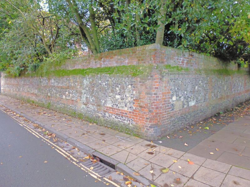
1833 COLEBROOK STREET
(South Side)
Wall of Nos 27 & 28
SU 4829 SW 6/61A
II
2.
C18. Rubble and flint panels with red brick piers, bands and coping.
Listing NGR: SU4848929182
External links are from the relevant listing authority and, where applicable, Wikidata. Wikidata IDs may be related buildings as well as this specific building. If you want to add or update a link, you will need to do so by editing the Wikidata entry.


Other nearby listed buildings
