Approximate Location Map
Large Map »
Latitude: 51.0569 / 51°3'24"N
Longitude: -1.3156 / 1°18'56"W
OS Eastings: 448063
OS Northings: 128838
OS Grid: SU480288
Mapcode National: GBR 861.Q5Z
Mapcode Global: FRA 864B.792
Plus Code: 9C3W3M4M+QQ
Entry Name: St Mary's College Wall to South of South Africa Gateway
Listing Date: 14 January 1974
Grade: II
Source: Historic England
Source ID: 1095487
English Heritage Legacy ID: 144543
ID on this website: 101095487
Location: The Close, Winchester, Hampshire, SO23
County: Hampshire
District: Winchester
Electoral Ward/Division: St Michael
Parish: Non Civil Parish
Built-Up Area: Winchester
Traditional County: Hampshire
Lieutenancy Area (Ceremonial County): Hampshire
Tagged with: Building
1.
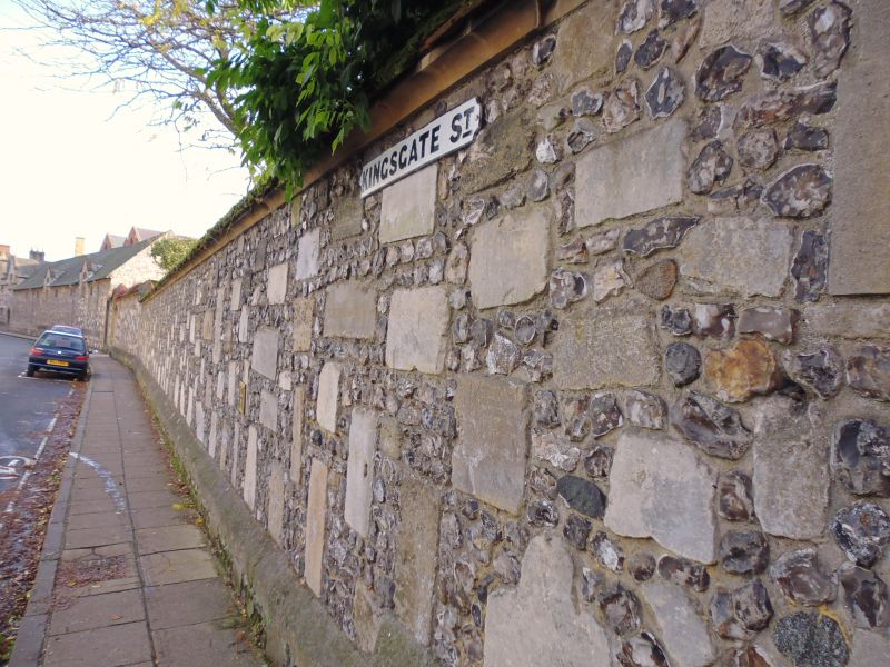
1833 COLLEGE STREET
(South Side)
St Mary's College.
Wall to south of
South Africa Gateway
SU 4828 NW 8/13A
II GV
2.
Circa 1900. Flint wall contemporary with the buildings.
All the listed buildings in College Street form a group.
Listing NGR: SU4826829006
External links are from the relevant listing authority and, where applicable, Wikidata. Wikidata IDs may be related buildings as well as this specific building. If you want to add or update a link, you will need to do so by editing the Wikidata entry.


Other nearby listed buildings
