Approximate Location Map
Large Map »
Latitude: 51.0566 / 51°3'23"N
Longitude: -1.3097 / 1°18'35"W
OS Eastings: 448474
OS Northings: 128809
OS Grid: SU484288
Mapcode National: GBR 861.RPF
Mapcode Global: FRA 864B.9KZ
Plus Code: 9C3W3M4R+J4
Entry Name: Blackbridge House
Listing Date: 14 January 1974
Grade: II
Source: Historic England
Source ID: 1350668
English Heritage Legacy ID: 144565
ID on this website: 101350668
Location: Wharf Hill, Winchester, Hampshire, SO23
County: Hampshire
District: Winchester
Electoral Ward/Division: St Michael
Parish: Non Civil Parish
Built-Up Area: Winchester
Traditional County: Hampshire
Lieutenancy Area (Ceremonial County): Hampshire
Tagged with: House
1.
1833 COLLEGE WALK
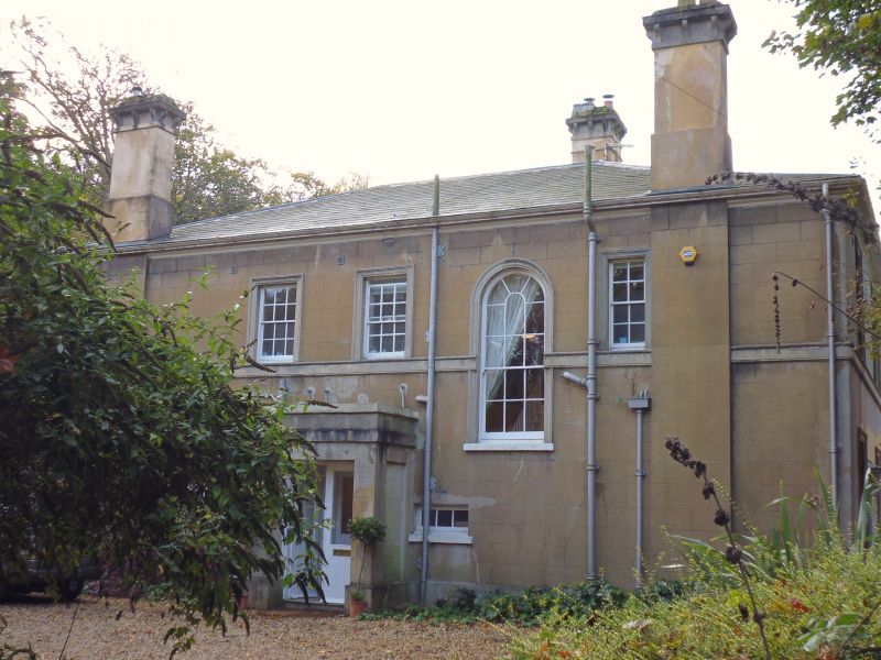
Blackbridge House
SU 4828 NW 8/338
II
2.
Early/mid C19. Rendered. Two storeys. Three windows on the entrance
front. sashes with glazing bars. Tall arched staircase window. Projecting
plain porch. Hipped slate roof. Later brick additions on left.
Listing NGR: SU4847228810
External links are from the relevant listing authority and, where applicable, Wikidata. Wikidata IDs may be related buildings as well as this specific building. If you want to add or update a link, you will need to do so by editing the Wikidata entry.


Other nearby listed buildings
