Approximate Location Map
Large Map »
Latitude: 51.0646 / 51°3'52"N
Longitude: -1.3156 / 1°18'56"W
OS Eastings: 448053
OS Northings: 129696
OS Grid: SU480296
Mapcode National: GBR 861.46J
Mapcode Global: FRA 8649.M92
Plus Code: 9C3W3M7M+RQ
Entry Name: 29A, Jewry Street
Listing Date: 14 January 1974
Grade: II
Source: Historic England
Source ID: 1173019
English Heritage Legacy ID: 144667
ID on this website: 101173019
Location: Hyde, Winchester, Hampshire, SO23
County: Hampshire
District: Winchester
Electoral Ward/Division: St Michael
Parish: Non Civil Parish
Built-Up Area: Winchester
Traditional County: Hampshire
Lieutenancy Area (Ceremonial County): Hampshire
Church of England Parish: Winchester Holy Trinity
Church of England Diocese: Winchester
Tagged with: Building
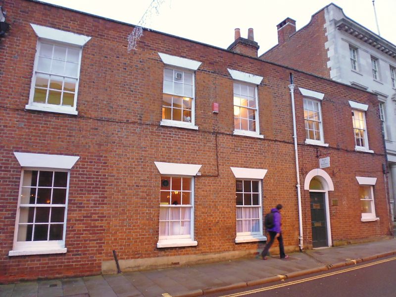
JEWRY STREET
1.
1833
(East Side)
No 29A
SU 4829 NW 3/381
II
2.
Early/Mid C19. Red brick. Two storeys, five windows, all except one
sashes with glazing bars, shutters to the upper window. Four-panel door
with fanlight over. Parapet, roof not visible.
Listing NGR: SU4805629693
External links are from the relevant listing authority and, where applicable, Wikidata. Wikidata IDs may be related buildings as well as this specific building. If you want to add or update a link, you will need to do so by editing the Wikidata entry.


Other nearby listed buildings
