Approximate Location Map
Large Map »
Latitude: 51.0559 / 51°3'21"N
Longitude: -1.3166 / 1°18'59"W
OS Eastings: 447994
OS Northings: 128731
OS Grid: SU479287
Mapcode National: GBR 861.PYB
Mapcode Global: FRA 864B.6X4
Plus Code: 9C3W3M4M+99
Entry Name: Wall of No 48
Listing Date: 14 January 1974
Grade: II
Source: Historic England
Source ID: 1095426
English Heritage Legacy ID: 144687
ID on this website: 101095426
Location: The Close, Winchester, Hampshire, SO23
County: Hampshire
District: Winchester
Electoral Ward/Division: St Michael
Parish: Non Civil Parish
Built-Up Area: Winchester
Traditional County: Hampshire
Lieutenancy Area (Ceremonial County): Hampshire
Church of England Parish: Winchester St Cross Hospital with St Faith
Church of England Diocese: Winchester
Tagged with: Wall
KINGSGATE ROAD
1.
1833
(West Side)
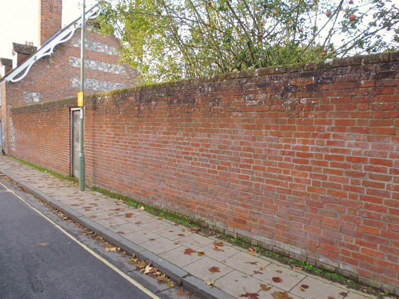
Wall of No 48
SU 4828 NW 8/158B
SU 42 NE 12/158B
II GV
2.
C18. Red brick and rubble, heightened later.
The listed buildings from No 40 to Kingsgate House form a group.
Listing NGR: SU4798428724
External links are from the relevant listing authority and, where applicable, Wikidata. Wikidata IDs may be related buildings as well as this specific building. If you want to add or update a link, you will need to do so by editing the Wikidata entry.


Other nearby listed buildings
