Approximate Location Map
Large Map »
Latitude: 51.0627 / 51°3'45"N
Longitude: -1.3063 / 1°18'22"W
OS Eastings: 448711
OS Northings: 129494
OS Grid: SU487294
Mapcode National: GBR 862.6L4
Mapcode Global: FRA 8649.YR8
Plus Code: 9C3W3M7V+3F
Entry Name: 21, St John's Street
Listing Date: 14 January 1974
Grade: II
Source: Historic England
Source ID: 1095385
English Heritage Legacy ID: 144780
ID on this website: 101095385
Location: Winchester, Hampshire, SO23
County: Hampshire
District: Winchester
Electoral Ward/Division: St Bartholomew
Parish: Non Civil Parish
Built-Up Area: Winchester
Traditional County: Hampshire
Lieutenancy Area (Ceremonial County): Hampshire
Church of England Parish: Winchester St John the Baptist with St Martin Winnall
Church of England Diocese: Winchester
Tagged with: Building
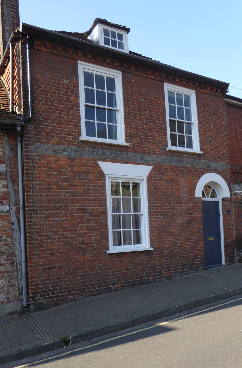
ST JOHN'S STREET
1.
1833
(West Side)
No 21
SU 4829 SE 7/219
II
2.
Early C19. 2 storeys and attic. Red brick with grey brick string. Old
tile roof. 2 windows. Plain recessed door, flush panelled, fanlight.
Sash windows with glazing bars, one dormer.
Listing NGR: SU4871129494
External links are from the relevant listing authority and, where applicable, Wikidata. Wikidata IDs may be related buildings as well as this specific building. If you want to add or update a link, you will need to do so by editing the Wikidata entry.


Other nearby listed buildings
