Approximate Location Map
Large Map »
Latitude: 51.0593 / 51°3'33"N
Longitude: -1.3148 / 1°18'53"W
OS Eastings: 448118
OS Northings: 129111
OS Grid: SU481291
Mapcode National: GBR 861.JDS
Mapcode Global: FRA 864B.1LY
Plus Code: 9C3W3M5P+P3
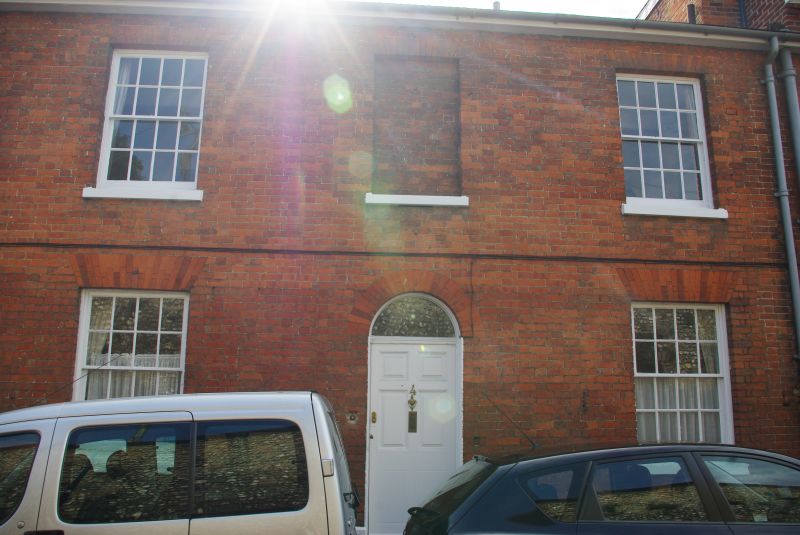
Entry Name: 4, St Swithun Street
Listing Date: 14 January 1974
Grade: II
Source: Historic England
Source ID: 1173730
English Heritage Legacy ID: 144806
ID on this website: 101173730
Location: The Close, Winchester, Hampshire, SO23
County: Hampshire
District: Winchester
Electoral Ward/Division: St Michael
Parish: Non Civil Parish
Built-Up Area: Winchester
Traditional County: Hampshire
Lieutenancy Area (Ceremonial County): Hampshire
Church of England Parish: Winchester St Lawrence with St Swithun-upon-Kingsgate
Church of England Diocese: Winchester
Tagged with: Building
ST SWITHUN STREET
1.
1833
No 4
SU 4829 SW 6/416
II
2.
Early C19. Red brick. Two storeys two windows with a blank over the
central door. Sash windows with glazing bars in rubbed heads. Six-panel
door with fanlight. Slate roof.
Listing NGR: SU4812029109
External links are from the relevant listing authority and, where applicable, Wikidata. Wikidata IDs may be related buildings as well as this specific building. If you want to add or update a link, you will need to do so by editing the Wikidata entry.


Other nearby listed buildings
