Approximate Location Map
Large Map »
Latitude: 51.0677 / 51°4'3"N
Longitude: -1.186 / 1°11'9"W
OS Eastings: 457134
OS Northings: 130136
OS Grid: SU571301
Mapcode National: GBR 97C.T52
Mapcode Global: FRA 86D9.HS5
Plus Code: 9C3W3R97+3J
Entry Name: Granary 20 Metres East of Grange Farmhouse
Listing Date: 19 December 1983
Grade: II
Source: Historic England
Source ID: 1095939
English Heritage Legacy ID: 145534
ID on this website: 101095939
Location: Tichborne, Winchester, Hampshire, SO24
County: Hampshire
District: Winchester
Civil Parish: Tichborne
Traditional County: Hampshire
Lieutenancy Area (Ceremonial County): Hampshire
Church of England Parish: Tichborne St Andrew
Church of England Diocese: Winchester
Tagged with: Granary
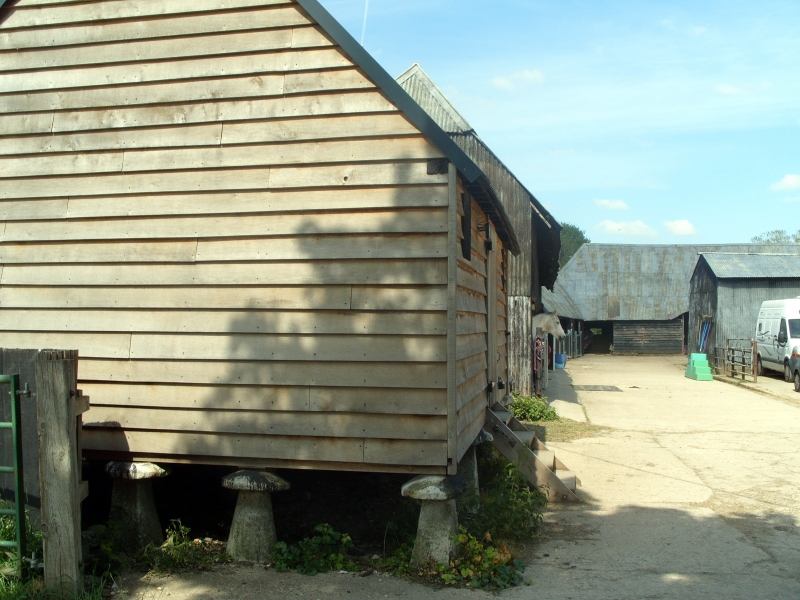
SU 5730 TICHBORNE TICHBORNE
10/17 Granary 20m E of
Grange Farmhouse
GV II
Granary. C18. Timber-frame weatherboarded on staddle stones, corrugated iron roof.
On 12 staddle stones with door in centre of front and 2 small loft doors in top
corners.
Listing NGR: SU5713430135
External links are from the relevant listing authority and, where applicable, Wikidata. Wikidata IDs may be related buildings as well as this specific building. If you want to add or update a link, you will need to do so by editing the Wikidata entry.


Other nearby listed buildings
