Approximate Location Map
Large Map »
Latitude: 51.0193 / 51°1'9"N
Longitude: -1.3206 / 1°19'14"W
OS Eastings: 447751
OS Northings: 124660
OS Grid: SU477246
Mapcode National: GBR 86M.2XM
Mapcode Global: FRA 863F.5BY
Plus Code: 9C3W2M9H+PQ
Entry Name: Norris Bridge
Listing Date: 27 November 1984
Grade: II
Source: Historic England
Source ID: 1095711
English Heritage Legacy ID: 146008
ID on this website: 101095711
Location: Twyford, Winchester, Hampshire, SO21
County: Hampshire
District: Winchester
Civil Parish: Twyford
Built-Up Area: Twyford
Traditional County: Hampshire
Lieutenancy Area (Ceremonial County): Hampshire
Church of England Parish: Twyford St Mary
Church of England Diocese: Winchester
Tagged with: Bridge
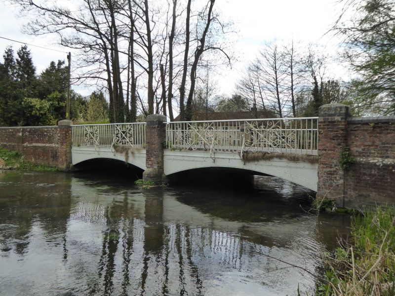
SU 4724 TWYFORD SHAWFORD ROAD
11/5 Norris Bridge
II
Road bridge. 1897 on tablet. 2 cast iron arches between brick piers with
brick flanking walls and wrought iron railings. Flanking wall of plinth
with panels between piers. Large piers each end and in the centre. Cast
iron arches with wrought iron railings with pairs of scroll work panels.
Listing NGR: SP4517227942
External links are from the relevant listing authority and, where applicable, Wikidata. Wikidata IDs may be related buildings as well as this specific building. If you want to add or update a link, you will need to do so by editing the Wikidata entry.


Other nearby listed buildings
