Approximate Location Map
Large Map »
Latitude: 50.9088 / 50°54'31"N
Longitude: -1.2489 / 1°14'56"W
OS Eastings: 452902
OS Northings: 112411
OS Grid: SU529124
Mapcode National: GBR 996.WKR
Mapcode Global: FRA 868P.WT0
Plus Code: 9C2WWQ52+GC
Entry Name: Granary at Fairthorne Grange
Listing Date: 1 September 1987
Grade: II
Source: Historic England
Source ID: 1179314
English Heritage Legacy ID: 146155
ID on this website: 101179314
Location: Curbridge, Winchester, Hampshire, SO30
County: Hampshire
District: Winchester
Civil Parish: Curdridge
Traditional County: Hampshire
Lieutenancy Area (Ceremonial County): Hampshire
Church of England Parish: Curdridge St Peter
Church of England Diocese: Portsmouth
Tagged with: Granary
CURDRIDGE
SU 51 SW
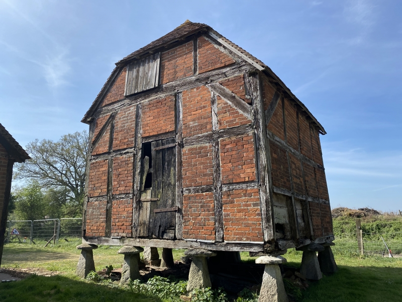
5/13 Granary at Fairthorne
Grange
II
Granary. C18. Bricknogged timber frame on 4 x 4 staddles; half-hipped tile roof.
Listing NGR: SU5246112940
External links are from the relevant listing authority and, where applicable, Wikidata. Wikidata IDs may be related buildings as well as this specific building. If you want to add or update a link, you will need to do so by editing the Wikidata entry.


Other nearby listed buildings
