Approximate Location Map
Large Map »
Latitude: 50.8719 / 50°52'18"N
Longitude: -1.1432 / 1°8'35"W
OS Eastings: 460385
OS Northings: 108389
OS Grid: SU603083
Mapcode National: GBR 99X.CSH
Mapcode Global: FRA 86HS.NH8
Plus Code: 9C2WVVC4+PP
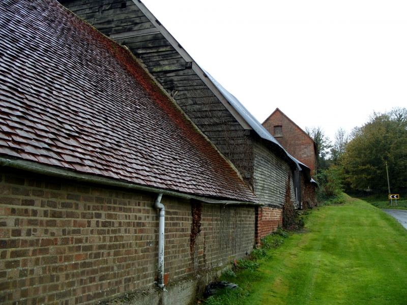
Entry Name: Barn 35 Metres West of Manor Farmhouse
Listing Date: 24 September 1987
Grade: II
Source: Historic England
Source ID: 1350615
English Heritage Legacy ID: 146334
ID on this website: 101350615
Location: Boarhunt, Winchester, Hampshire, PO17
County: Hampshire
District: Winchester
Civil Parish: Boarhunt
Traditional County: Hampshire
Lieutenancy Area (Ceremonial County): Hampshire
Church of England Parish: Boarhunt
Church of England Diocese: Portsmouth
Tagged with: Barn
SU 60 NW BOARHUNT
13/2 Barn 35 metres west of
Manor Farmhouse
GV II
Barn. C18. Timber frame of 5 bays, with aisle on one long side; Queen post truss. Boarded walls, some brick base walls. Half-hipped corrugated iron roof.
Listing NGR: SU6046008389
External links are from the relevant listing authority and, where applicable, Wikidata. Wikidata IDs may be related buildings as well as this specific building. If you want to add or update a link, you will need to do so by editing the Wikidata entry.


Other nearby listed buildings
