Approximate Location Map
Large Map »
Latitude: 50.9749 / 50°58'29"N
Longitude: -1.1276 / 1°7'39"W
OS Eastings: 461344
OS Northings: 119858
OS Grid: SU613198
Mapcode National: GBR 98L.XBH
Mapcode Global: FRA 86JJ.NHW
Plus Code: 9C2WXVFC+XX
Entry Name: Hales Farm
Listing Date: 24 September 1987
Grade: II
Source: Historic England
Source ID: 1095603
English Heritage Legacy ID: 146361
ID on this website: 101095603
Location: Meonstoke, Winchester, Hampshire, SO32
County: Hampshire
District: Winchester
Civil Parish: Corhampton and Meonstoke
Built-Up Area: Meonstoke
Traditional County: Hampshire
Lieutenancy Area (Ceremonial County): Hampshire
Church of England Parish: Meonstoke with Corhampton
Church of England Diocese: Portsmouth
Tagged with: Building
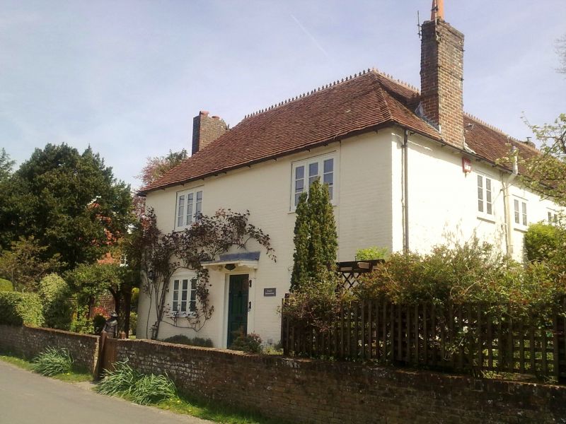
SU 61 NW CORHAMPTON & MEONSTOKE HIGH STREET
7/11 Hales Farm
GV II
House. Early C19. Walls of painted brickwork in Flemish Garden Wall bond,
cambered ground-floor openings. Hipped tile roof. Symmetrical west front of two
storeys two windows. Casements. Boarded door in a plain frame. Included for
group value.
Listing NGR: SU6134419856
External links are from the relevant listing authority and, where applicable, Wikidata. Wikidata IDs may be related buildings as well as this specific building. If you want to add or update a link, you will need to do so by editing the Wikidata entry.


Other nearby listed buildings
