Approximate Location Map
Large Map »
Latitude: 51.0092 / 51°0'33"N
Longitude: -1.1608 / 1°9'38"W
OS Eastings: 458974
OS Northings: 123644
OS Grid: SU589236
Mapcode National: GBR 985.MCD
Mapcode Global: FRA 86GF.TX8
Plus Code: 9C3W2R5Q+MM
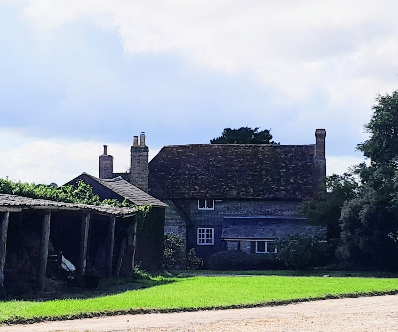
Entry Name: Lomer Farmhouse
Listing Date: 24 September 1987
Grade: II
Source: Historic England
Source ID: 1350631
English Heritage Legacy ID: 146422
ID on this website: 101350631
Location: Winchester, Hampshire, SO32
County: Hampshire
District: Winchester
Civil Parish: Exton
Traditional County: Hampshire
Lieutenancy Area (Ceremonial County): Hampshire
Tagged with: Farmhouse
SU 52 SE EXTON
3/2 Lomer Farmhouse
II
House. C18, and mid C19. Walls of brickwork in Flemish and Flemish Garden Wall
bond, some cambered openings: some areas of flintwork, tile-hanging to part.
Tile roof, hipped and half-hipped: slate above outshot. L-shaped block with
minor extensions; two storeys, irregular fenestrations. Casements. 6-panelled
(2 top glazed) door beneath pediment hood.
Listing NGR: SU5902023729
External links are from the relevant listing authority and, where applicable, Wikidata. Wikidata IDs may be related buildings as well as this specific building. If you want to add or update a link, you will need to do so by editing the Wikidata entry.


Other nearby listed buildings
