Approximate Location Map
Large Map »
Latitude: 52.2691 / 52°16'8"N
Longitude: -2.151 / 2°9'3"W
OS Eastings: 389792
OS Northings: 263445
OS Grid: SO897634
Mapcode National: GBR 1F8.P0R
Mapcode Global: VH92G.N7QC
Plus Code: 9C4V7R9X+JJ
Entry Name: 42 and 44, Friar Street
Listing Date: 20 September 1973
Grade: II
Source: Historic England
Source ID: 1296683
English Heritage Legacy ID: 147340
ID on this website: 101296683
Location: The Vines, Wychavon, Worcestershire, WR9
County: Worcestershire
District: Wychavon
Civil Parish: Droitwich Spa
Built-Up Area: Droitwich
Traditional County: Worcestershire
Lieutenancy Area (Ceremonial County): Worcestershire
Church of England Parish: Droitwich Spa
Church of England Diocese: Worcester
Tagged with: Building
1.
1054
SO 8963
1/9
FRIAR STREET
(South Side)
Nos 42 and 44
II
GV
2.
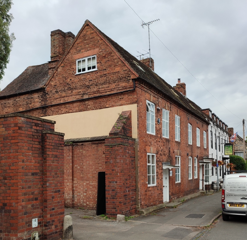
Late C18 pair. 2 storeys, 6 windows. Red brick. Unbarred mullion transom
casements with cambered heads. 2 doors, fielded panels. Simple hoods on heavy
brackets. Right hand door has moulded wood case.
Nos 36 to 44 (even) form a good group.
Listing NGR: SO8979263445
External links are from the relevant listing authority and, where applicable, Wikidata. Wikidata IDs may be related buildings as well as this specific building. If you want to add or update a link, you will need to do so by editing the Wikidata entry.


Other nearby listed buildings
