Approximate Location Map
Large Map »
Latitude: 52.2687 / 52°16'7"N
Longitude: -2.1493 / 2°8'57"W
OS Eastings: 389905
OS Northings: 263403
OS Grid: SO899634
Mapcode National: GBR 1F8.PDY
Mapcode Global: VH92G.P7LN
Plus Code: 9C4V7V92+F7
Entry Name: 58, Friar Street
Listing Date: 20 September 1973
Grade: II
Source: Historic England
Source ID: 1167899
English Heritage Legacy ID: 147342
ID on this website: 101167899
Location: The Vines, Wychavon, Worcestershire, WR9
County: Worcestershire
District: Wychavon
Civil Parish: Droitwich Spa
Built-Up Area: Droitwich
Traditional County: Worcestershire
Lieutenancy Area (Ceremonial County): Worcestershire
Church of England Parish: Droitwich Spa
Church of England Diocese: Worcester
Tagged with: Building
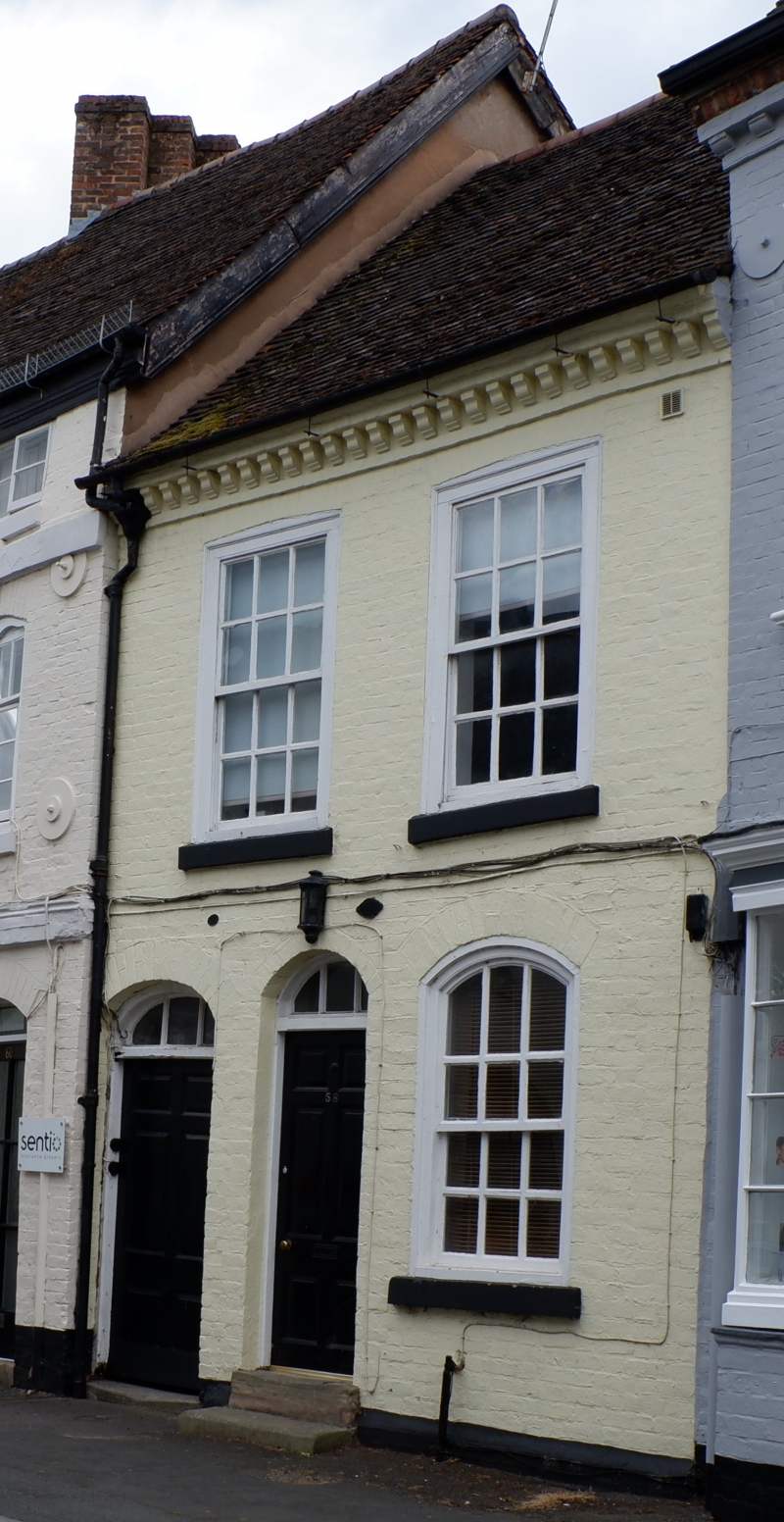
1.
1054 FRIAR STREET
(South Side)
No 58
SO 8963 1/11
II GV
2.
Probably mid C18 but much altered. 2 storeys. 2 windows. Painted brick. 12
pane sashes with cills, flush boxing, cambered heads. 2 doors with 6 fielded
panels. 3-light segmental fanlight. (Abuts No 58).
Nos 56 to 66 (even) form a good group.
Listing NGR: SO8990563401
External links are from the relevant listing authority and, where applicable, Wikidata. Wikidata IDs may be related buildings as well as this specific building. If you want to add or update a link, you will need to do so by editing the Wikidata entry.


Other nearby listed buildings
