Approximate Location Map
Large Map »
Latitude: 52.2683 / 52°16'5"N
Longitude: -2.1478 / 2°8'51"W
OS Eastings: 390012
OS Northings: 263354
OS Grid: SO900633
Mapcode National: GBR 1F8.PT5
Mapcode Global: VH92G.Q7FZ
Plus Code: 9C4V7V92+8V
Entry Name: 10, High Street
Listing Date: 24 October 1951
Grade: II
Source: Historic England
Source ID: 1095975
English Heritage Legacy ID: 147356
ID on this website: 101095975
Location: Droitwich Spa, Wychavon, Worcestershire, WR9
County: Worcestershire
District: Wychavon
Civil Parish: Droitwich Spa
Built-Up Area: Droitwich
Traditional County: Worcestershire
Lieutenancy Area (Ceremonial County): Worcestershire
Church of England Parish: Droitwich Spa
Church of England Diocese: Worcester
Tagged with: Building
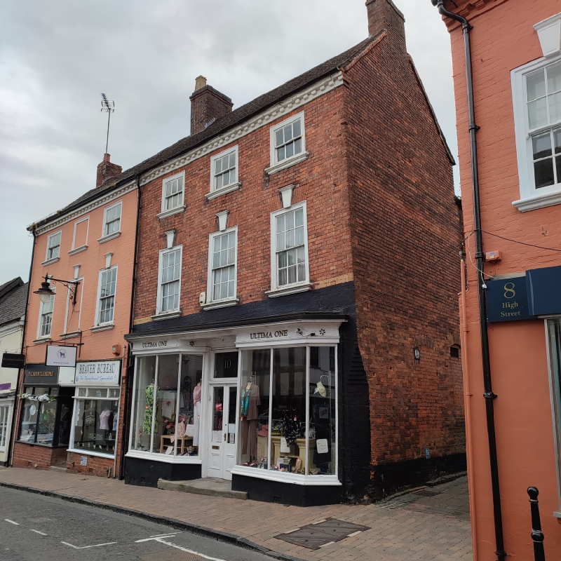
1.
1054 HIGH STREET
(South Side)
No 10
SO 9063 2/22 24.10.51.
II GV
2.
Mid C18. Red brick. 3 storeys. 3 12-pane sashes with moulded keyblocks and
sills, the uppers reduced in height. Mid C19 double-fronted shop. Brick eaves;
old tiles.
All the listed buildings on the South Side from Nos 2 to 24 (even) form a good
group.
Listing NGR: SO9001063350
External links are from the relevant listing authority and, where applicable, Wikidata. Wikidata IDs may be related buildings as well as this specific building. If you want to add or update a link, you will need to do so by editing the Wikidata entry.


Other nearby listed buildings
