Approximate Location Map
Large Map »
Latitude: 52.2678 / 52°16'4"N
Longitude: -2.1492 / 2°8'57"W
OS Eastings: 389912
OS Northings: 263307
OS Grid: SO899633
Mapcode National: GBR 1F8.X03
Mapcode Global: VH92G.P8NB
Plus Code: 9C4V7V92+48
Entry Name: The Spinning Wheel
Listing Date: 24 October 1951
Grade: II
Source: Historic England
Source ID: 1167969
English Heritage Legacy ID: 147364
ID on this website: 101167969
Location: The Vines, Wychavon, Worcestershire, WR9
County: Worcestershire
District: Wychavon
Civil Parish: Droitwich Spa
Built-Up Area: Droitwich
Traditional County: Worcestershire
Lieutenancy Area (Ceremonial County): Worcestershire
Church of England Parish: Droitwich Spa
Church of England Diocese: Worcester
Tagged with: Architectural structure
1.
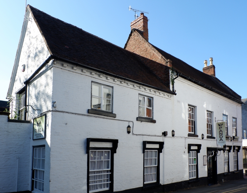
1054 ST ANDREW'S STREET
(West Side)
No 13
(The Spinning Wheel)
SO 8963 1/42 24.10.51.
II
2.
Mid C18 painted brick to part earlier timber frame. 2 storeys. 4 12-pane sashes.
Moulded wood doorcase with hood on curved iron brackets. Moulded brick eaves;
old tiles; gabled ends.
Listing NGR: SO8991263307
External links are from the relevant listing authority and, where applicable, Wikidata. Wikidata IDs may be related buildings as well as this specific building. If you want to add or update a link, you will need to do so by editing the Wikidata entry.


Other nearby listed buildings
