Approximate Location Map
Large Map »
Latitude: 52.1143 / 52°6'51"N
Longitude: -1.8908 / 1°53'26"W
OS Eastings: 407572
OS Northings: 246224
OS Grid: SP075462
Mapcode National: GBR 3L6.GR5
Mapcode Global: VHB0V.54R0
Plus Code: 9C4W4475+PM
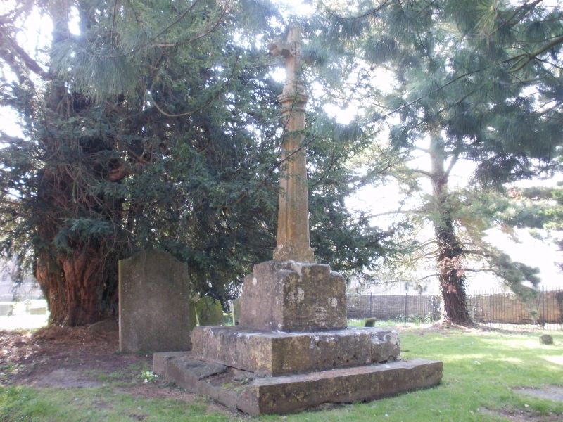
Entry Name: Churchyard Cross in St Michael's Churchyard
Listing Date: 30 July 1959
Grade: II
Source: Historic England
Source ID: 1303161
English Heritage Legacy ID: 147663
ID on this website: 101303161
Location: St Michael's Church, South Littleton, Wychavon, Worcestershire, WR11
County: Worcestershire
District: Wychavon
Civil Parish: South Littleton
Built-Up Area: South Littleton
Traditional County: Worcestershire
Lieutenancy Area (Ceremonial County): Worcestershire
Church of England Parish: South Littleton
Church of England Diocese: Worcester
Tagged with: Churchyard cross
SP 0704 SOUTH LITTLETON MAIN STREET
6/32 (West Side)
30.7.59 Churchyard Cross in
St Michael's Church-
yard
II
Churchyard cross, late medieval, stone. Square base chamfered to octagonal raised on
2 steps. Modern shaft and corss.
Listing NGR: SP0757246224
External links are from the relevant listing authority and, where applicable, Wikidata. Wikidata IDs may be related buildings as well as this specific building. If you want to add or update a link, you will need to do so by editing the Wikidata entry.


Other nearby listed buildings
