Approximate Location Map
Large Map »
Latitude: 52.2352 / 52°14'6"N
Longitude: -2.0729 / 2°4'22"W
OS Eastings: 395117
OS Northings: 259666
OS Grid: SO951596
Mapcode National: GBR 2H2.YHV
Mapcode Global: VHB05.02ZV
Plus Code: 9C4V6WPG+3R
Entry Name: Packhorse Bridge About 100 Yards South of Shell Manor
Listing Date: 29 December 1952
Grade: II
Source: Historic England
Source ID: 1350154
English Heritage Legacy ID: 147851
ID on this website: 101350154
Location: Shell, Wychavon, Worcestershire, WR9
County: Worcestershire
District: Wychavon
Civil Parish: Himbleton
Traditional County: Worcestershire
Lieutenancy Area (Ceremonial County): Worcestershire
Tagged with: Packhorse bridge
HIMBLETON CP SHELL
SO 95 NE
SO 95115967
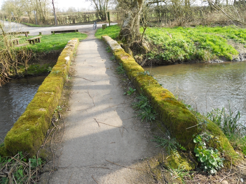
Packhorse Bridge
7/175 (19/9)
about 100 yards south
of Shell Manor
29.12.52
- II
Packhorse bridge. C17 or earlier. Lias limestone rubble with sandstone
dressings. Two round arches and low parapet with sandstone coping. About
five feet high and five feet wide between parapets which are slightly
splayed at ends. (BoE, p 196).
Listing NGR: SO9511759666
External links are from the relevant listing authority and, where applicable, Wikidata. Wikidata IDs may be related buildings as well as this specific building. If you want to add or update a link, you will need to do so by editing the Wikidata entry.


Other nearby listed buildings
