Approximate Location Map
Large Map »
Latitude: 52.28 / 52°16'48"N
Longitude: -2.2424 / 2°14'32"W
OS Eastings: 383562
OS Northings: 264682
OS Grid: SO835646
Mapcode National: GBR 1F4.3WL
Mapcode Global: VH927.2YXH
Plus Code: 9C4V7QJ5+23
Entry Name: Out Building with Cider Mill About 10 Yards South of Pipstyle House
Listing Date: 29 December 1952
Grade: II
Source: Historic England
Source ID: 1173449
English Heritage Legacy ID: 148066
ID on this website: 101173449
Location: Uphampton, Wychavon, Worcestershire, WR9
County: Worcestershire
District: Wychavon
Civil Parish: Ombersley
Built-Up Area: Uphampton
Traditional County: Worcestershire
Lieutenancy Area (Ceremonial County): Worcestershire
Church of England Parish: Ombersley
Church of England Diocese: Worcester
Tagged with: Architectural structure
SO 86 SW OMBERSLEY CP UPHAMPTON
3/171 Out building with
cider mill about 10 yards
south of Pipstyle House
29.12.52
GV II
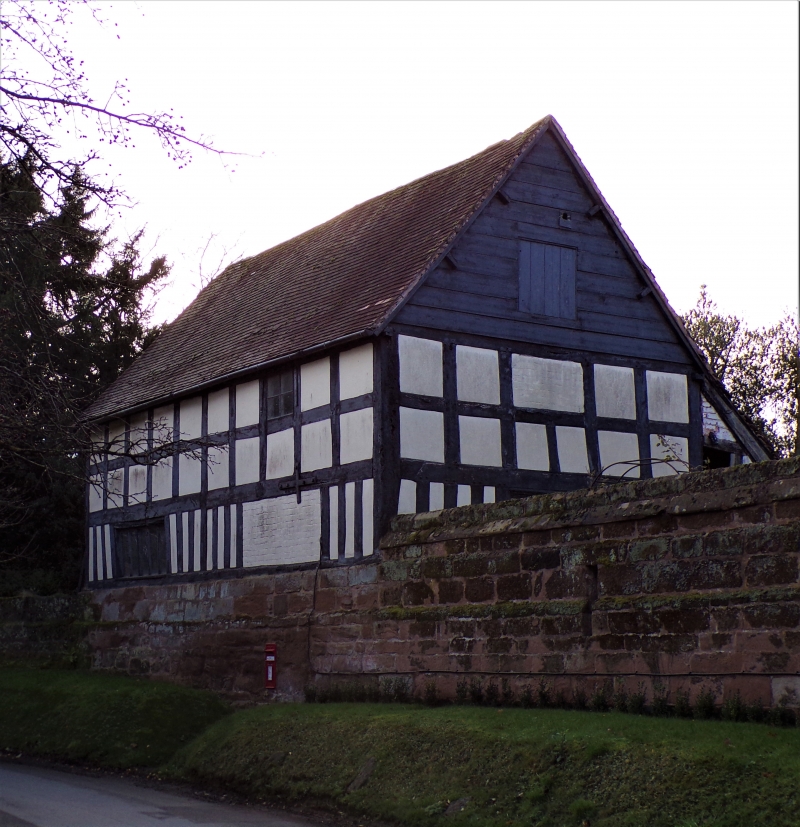
Outbuilding, with cider mill, now store. Late C16 with mid-C19 alterations
and additions. Part timber-framed, rendered infill, some weatherboarding
and part sandstone rubble and brick walling, tall sandstone rubble plinth,
plain tiled roof, brick stack at rear. Two framed bays; two storeys.
Framing: lower row of close-set vertical studding with two upper rows of
square panels; tie-beam trusses with two collars and queen struts.
East side elevation facing road has 5-light, ovolo moulded wood mullioned
window and first floor square light. North gable end facing house has a
4-light, ovolo moulded wood mullioned window and a loft door. South gable
end has a first floor door and rectangular opening in gable. At rear side
to west is an outshut. Interior: roof partly renewed and has two rows of
trenched purlins and intermediate collar-and-tie-beam truss. Cider mill
in south bay; north bay once used as wash house and has a boiler, hearth etc.
Listing NGR: SO8356264682
External links are from the relevant listing authority and, where applicable, Wikidata. Wikidata IDs may be related buildings as well as this specific building. If you want to add or update a link, you will need to do so by editing the Wikidata entry.


Other nearby listed buildings
