Approximate Location Map
Large Map »
Latitude: 52.1779 / 52°10'40"N
Longitude: -1.9812 / 1°58'52"W
OS Eastings: 401383
OS Northings: 253296
OS Grid: SP013532
Mapcode National: GBR 2HZ.HXQ
Mapcode Global: VHB0D.LJZ8
Plus Code: 9C4W52H9+5G
Entry Name: Post Box
Listing Date: 28 June 1985
Grade: II
Source: Historic England
Source ID: 1096265
English Heritage Legacy ID: 148424
ID on this website: 101096265
Location: Rous Lench, Wychavon, Worcestershire, WR11
County: Worcestershire
District: Wychavon
Civil Parish: Rous Lench
Traditional County: Worcestershire
Lieutenancy Area (Ceremonial County): Worcestershire
Church of England Parish: Rous Lench
Church of England Diocese: Worcester
Tagged with: Post box
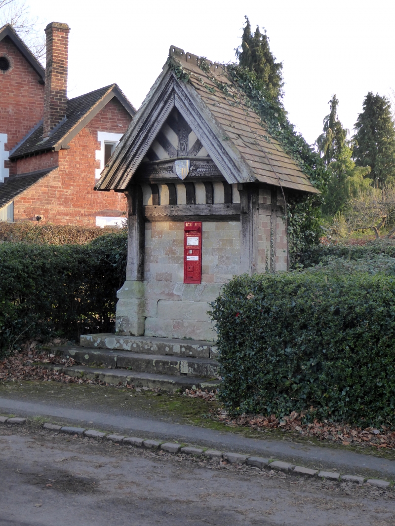
SP 05 SW ROUS LENCH CP THE GREEN (south-east corner)
8/150 Post Box
- II
Post Box. 1870's. Timber-frame with plastered infill on sandstone ashlar
plinth, tile roof. Gabled front with jettied tie-beam over painted cast iron
pillar box inscribed "VR". Moulded bargeboards to gable, truss has V-struts
to king-post, shield attached to centre of tie-beam (BoE p 256).
Listing NGR: SP0138253297
External links are from the relevant listing authority and, where applicable, Wikidata. Wikidata IDs may be related buildings as well as this specific building. If you want to add or update a link, you will need to do so by editing the Wikidata entry.


Other nearby listed buildings
