Approximate Location Map
Large Map »
Latitude: 52.1756 / 52°10'32"N
Longitude: -2.4963 / 2°29'46"W
OS Eastings: 366155
OS Northings: 253153
OS Grid: SO661531
Mapcode National: GBR FW.51DH
Mapcode Global: VH856.PL41
Plus Code: 9C4V5GG3+6F
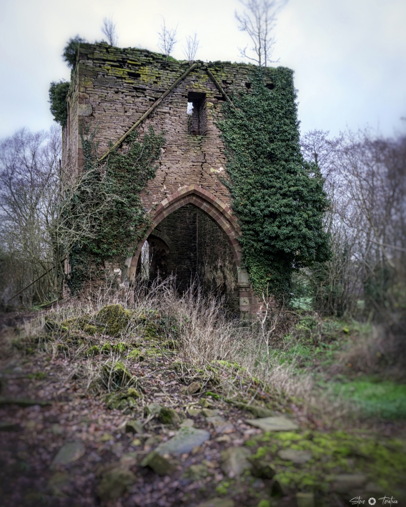
Entry Name: Ruins of Church of St Mary
Listing Date: 12 April 1973
Grade: II*
Source: Historic England
Source ID: 1349633
English Heritage Legacy ID: 150869
Also known as: Avenbury Church
ID on this website: 101349633
Location: County of Herefordshire, HR7
County: County of Herefordshire
Civil Parish: Avenbury
Traditional County: Herefordshire
Lieutenancy Area (Ceremonial County): Herefordshire
Church of England Parish: Bromyard
Church of England Diocese: Hereford
Tagged with: Church ruin
1.
1962 AVENBURY AVENBURY
Ruins of Church of
St Mary
So 65 SE 13/30
II*
2.
Early C13 west tower with low pyramid roof. Tower arch. Lancet windows.
Also fragments of Chancel walls with small Norman windows.
Listing NGR: SO6615553153
External links are from the relevant listing authority and, where applicable, Wikidata. Wikidata IDs may be related buildings as well as this specific building. If you want to add or update a link, you will need to do so by editing the Wikidata entry.


Other nearby listed buildings
