Approximate Location Map
Large Map »
Latitude: 52.0817 / 52°4'53"N
Longitude: -2.4123 / 2°24'44"W
OS Eastings: 371845
OS Northings: 242669
OS Grid: SO718426
Mapcode National: GBR FZ.C47Q
Mapcode Global: VH933.4YL2
Plus Code: 9C4V3HJQ+M3
Entry Name: Churchyard Cross
Listing Date: 6 March 1967
Grade: II*
Source: Historic England
Source ID: 1157237
English Heritage Legacy ID: 151402
ID on this website: 101157237
Location: All Saints' Church, Coddington, County of Herefordshire, HR8
County: County of Herefordshire
Civil Parish: Coddington
Traditional County: Herefordshire
Lieutenancy Area (Ceremonial County): Herefordshire
Church of England Parish: Coddington
Church of England Diocese: Hereford
Tagged with: Churchyard cross
SO 74 SW
3/2
6.3.67
CODDINGTON CP
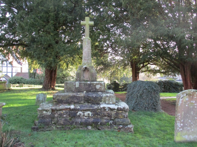
Churchyard Cross
GV
II*
Churchyard cross. C14 - C15. Sandstone. 3 steps to base, topped by
stone block having trefoil-headed niche in west face. Above the block,
truncated shaft supporting C20 cross.
Listing NGR: SO7184542669
External links are from the relevant listing authority and, where applicable, Wikidata. Wikidata IDs may be related buildings as well as this specific building. If you want to add or update a link, you will need to do so by editing the Wikidata entry.


Other nearby listed buildings
