Approximate Location Map
Large Map »
Latitude: 52.0345 / 52°2'4"N
Longitude: -2.4222 / 2°25'20"W
OS Eastings: 371130
OS Northings: 237433
OS Grid: SO711374
Mapcode National: GBR FZ.FV2G
Mapcode Global: VH860.Y4T4
Plus Code: 9C4V2HMH+R4
Entry Name: 20, the Southend
Listing Date: 5 November 1976
Grade: II
Source: Historic England
Source ID: 1082805
English Heritage Legacy ID: 151980
ID on this website: 101082805
Location: Ledbury, County of Herefordshire, HR8
County: County of Herefordshire
Civil Parish: Ledbury
Built-Up Area: Ledbury
Traditional County: Herefordshire
Lieutenancy Area (Ceremonial County): Herefordshire
Church of England Parish: Ledbury
Church of England Diocese: Hereford
Tagged with: Building
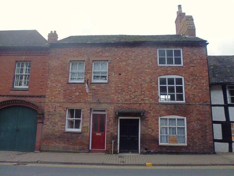
1.
5245 THE SOUTHEND
(West Side)
------------
No 20
SO 7137 SE 2/206
II GV
2.
C18 brick. Tiled roof with gable ends. Brick dentil eaves. 3 storeys. 1 window
wide. 3-light wood million/transom windows (in segmental headed openings on ground
and 1st floors). Wide plain doorway on left with hood on shaped brackets.
Nos 15, 16, 19 and 20 form a group.
Listing NGR: SO7113037433
External links are from the relevant listing authority and, where applicable, Wikidata. Wikidata IDs may be related buildings as well as this specific building. If you want to add or update a link, you will need to do so by editing the Wikidata entry.


Other nearby listed buildings
