Approximate Location Map
Large Map »
Latitude: 52.1192 / 52°7'8"N
Longitude: -2.3283 / 2°19'42"W
OS Eastings: 377614
OS Northings: 246810
OS Grid: SO776468
Mapcode National: GBR 0FN.063
Mapcode Global: VH92Y.LZGV
Plus Code: 9C4V4M9C+MM
Entry Name: 1, Bank Street
Listing Date: 11 May 1979
Grade: II
Source: Historic England
Source ID: 1082781
English Heritage Legacy ID: 152024
ID on this website: 101082781
Location: Link Top, Malvern Hills, Worcestershire, WR14
County: Worcestershire
District: Malvern Hills
Civil Parish: Malvern
Built-Up Area: Great Malvern
Traditional County: Worcestershire
Lieutenancy Area (Ceremonial County): Worcestershire
Church of England Parish: Malvern The Holy Trinity
Church of England Diocese: Worcester
Tagged with: Building
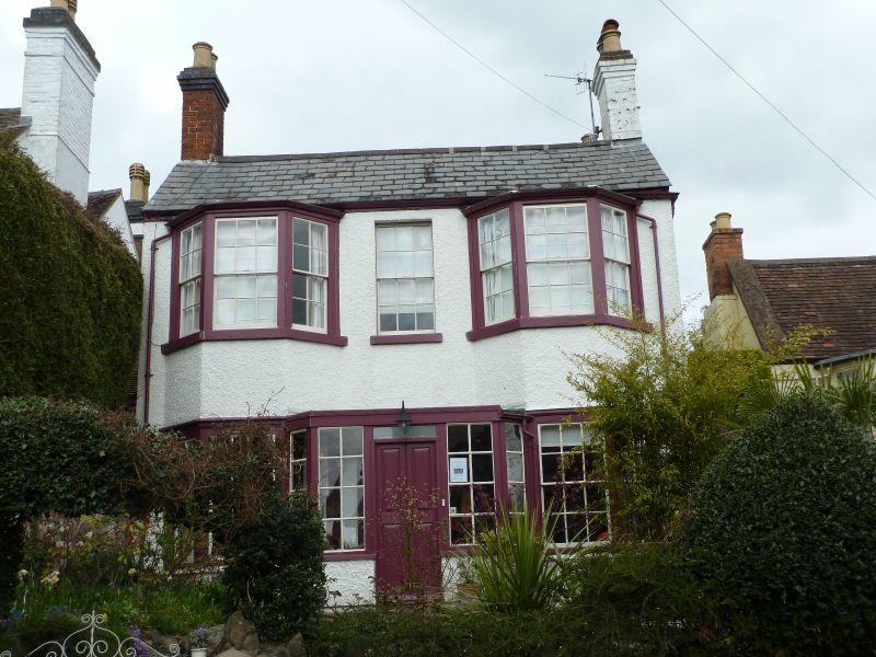
BANK STREET
1.
5245
(West side)
No 1
SO 7746 NE 1/33
II GV
2.
Early C19. Two storeys, roughcast, slate roofs, wide eaves, 2-storey, 3-window
canted bays flank a window above central panelled door beneath flat-top glazed
porch. Windows have hung sashes with glazing bars.
Listing NGR: SO7761446810
External links are from the relevant listing authority and, where applicable, Wikidata. Wikidata IDs may be related buildings as well as this specific building. If you want to add or update a link, you will need to do so by editing the Wikidata entry.


Other nearby listed buildings
