Approximate Location Map
Large Map »
Latitude: 52.1192 / 52°7'9"N
Longitude: -2.3283 / 2°19'41"W
OS Eastings: 377620
OS Northings: 246818
OS Grid: SO776468
Mapcode National: GBR 0FN.062
Mapcode Global: VH92Y.LZHS
Plus Code: 9C4V4M9C+MM
Entry Name: 3, Bank Street
Listing Date: 11 May 1979
Grade: II
Source: Historic England
Source ID: 1082782
English Heritage Legacy ID: 152025
ID on this website: 101082782
Location: Link Top, Malvern Hills, Worcestershire, WR14
County: Worcestershire
District: Malvern Hills
Civil Parish: Malvern
Built-Up Area: Great Malvern
Traditional County: Worcestershire
Lieutenancy Area (Ceremonial County): Worcestershire
Church of England Parish: Malvern The Holy Trinity
Church of England Diocese: Worcester
Tagged with: Building
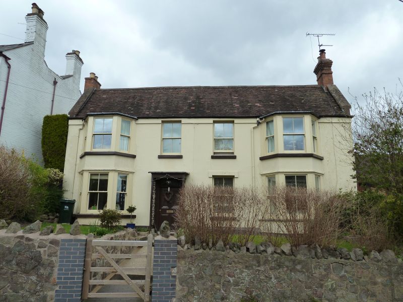
BANK STREET
1.
5245
(West Side)
No 3
SO 7746 NE 1/105
II GV
2.
Mid C19. Two-storeys, stucco, with tile roof with stacks at ends. Two canted
bays flank 2 windows, no glazing bars. Ground floor has 2 canted bays and
one window and door with rectangular fanlight, trellis porch.
Listing NGR: SO7762046818
External links are from the relevant listing authority and, where applicable, Wikidata. Wikidata IDs may be related buildings as well as this specific building. If you want to add or update a link, you will need to do so by editing the Wikidata entry.


Other nearby listed buildings
