Approximate Location Map
Large Map »
Latitude: 52.1109 / 52°6'39"N
Longitude: -2.3298 / 2°19'47"W
OS Eastings: 377512
OS Northings: 245895
OS Grid: SO775458
Mapcode National: GBR 0FM.RSC
Mapcode Global: VH934.K6PL
Plus Code: 9C4V4M6C+93
Entry Name: Wayside cross on Belle Vue Island
Listing Date: 11 May 1979
Grade: II
Source: Historic England
Source ID: 1082790
English Heritage Legacy ID: 152042
ID on this website: 101082790
Location: Great Malvern, Malvern Hills, Worcestershire, WR14
County: Worcestershire
District: Malvern Hills
Civil Parish: Malvern
Built-Up Area: Great Malvern
Traditional County: Worcestershire
Lieutenancy Area (Ceremonial County): Worcestershire
Church of England Parish: Great Malvern
Church of England Diocese: Worcester
Tagged with: Wayside cross
SO 7745 NE
5/182
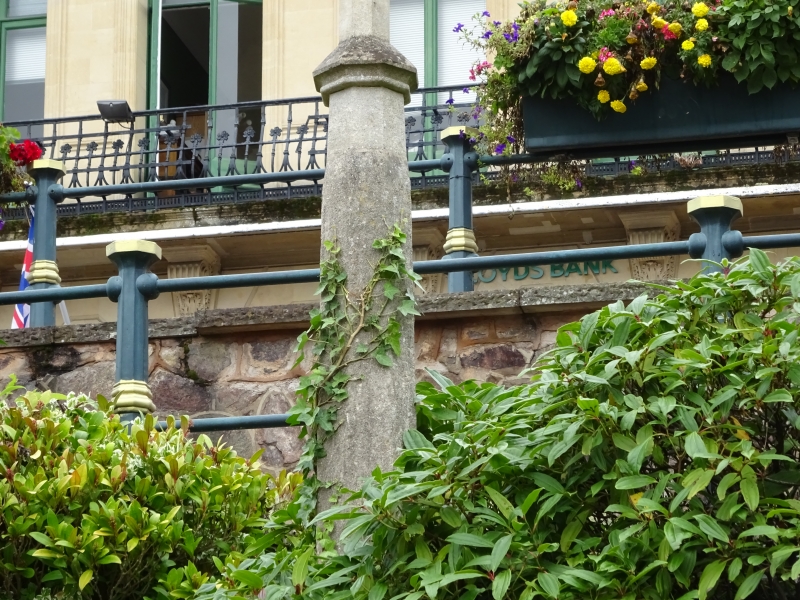
BELLE VUE TERRACE (east side)
Wayside cross on Belle Vue Island
II
Probably a late medieval cross, a tapering octagonal stone monolith shaft, the upper portion reconstructed with fillet necking and ball finial. Set on stone plinth.
Listing NGR: SO7751245895
External links are from the relevant listing authority and, where applicable, Wikidata. Wikidata IDs may be related buildings as well as this specific building. If you want to add or update a link, you will need to do so by editing the Wikidata entry.


Other nearby listed buildings
