Approximate Location Map
Large Map »
Latitude: 52.1147 / 52°6'52"N
Longitude: -2.3268 / 2°19'36"W
OS Eastings: 377721
OS Northings: 246313
OS Grid: SO777463
Mapcode National: GBR 0FN.DKK
Mapcode Global: VH934.M39Q
Plus Code: 9C4V4M7F+V7
Entry Name: 70, Graham Road
Listing Date: 11 May 1979
Grade: II
Source: Historic England
Source ID: 1349454
English Heritage Legacy ID: 152075
ID on this website: 101349454
Location: Great Malvern, Malvern Hills, Worcestershire, WR14
County: Worcestershire
District: Malvern Hills
Civil Parish: Malvern
Built-Up Area: Great Malvern
Traditional County: Worcestershire
Lieutenancy Area (Ceremonial County): Worcestershire
Church of England Parish: Great Malvern
Church of England Diocese: Worcester
Tagged with: Building
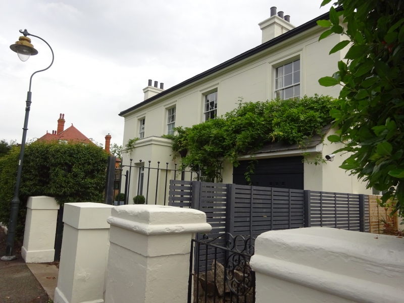
GRAHAM ROAD
1.
5245
(East Side)
No 70
SO 7746 NE 3/120
II GV
2.
Early-mid C19. Two storeys, stucco. Three windows in moulded architraves,
hung sashes with glazing bars. Two windows to ground floor and square porch
with cornice and half-glazed door, rectangular fanlight. String at cills.
Plinth.
Listing NGR: SO7772146309
External links are from the relevant listing authority and, where applicable, Wikidata. Wikidata IDs may be related buildings as well as this specific building. If you want to add or update a link, you will need to do so by editing the Wikidata entry.


Other nearby listed buildings
