Approximate Location Map
Large Map »
Latitude: 52.1158 / 52°6'56"N
Longitude: -2.3266 / 2°19'35"W
OS Eastings: 377732
OS Northings: 246431
OS Grid: SO777464
Mapcode National: GBR 0FN.6MC
Mapcode Global: VH934.M2CW
Plus Code: 9C4V4M8F+79
Entry Name: 86, Graham Road
Listing Date: 11 May 1979
Grade: II
Source: Historic England
Source ID: 1082762
English Heritage Legacy ID: 152076
ID on this website: 101082762
Location: Link Top, Malvern Hills, Worcestershire, WR14
County: Worcestershire
District: Malvern Hills
Civil Parish: Malvern
Built-Up Area: Great Malvern
Traditional County: Worcestershire
Lieutenancy Area (Ceremonial County): Worcestershire
Church of England Parish: Malvern The Holy Trinity
Church of England Diocese: Worcester
Tagged with: Building
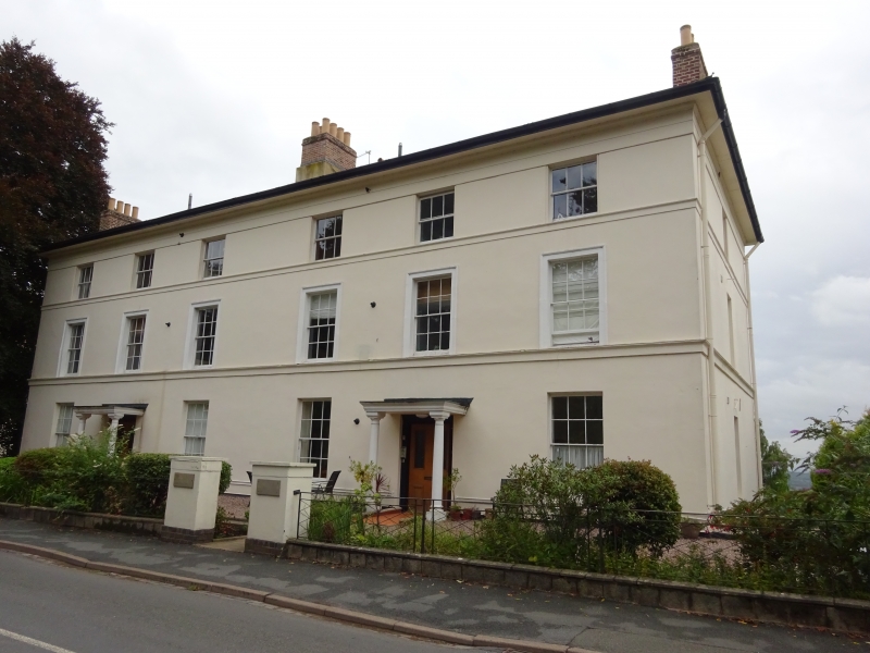
GRAHAM ROAD
1.
5245
(East Side)
No 86
SO 7746 SE 3/121
II
2.
Plain early-mid C19 villa of 3 storeys in stucco with slate roof and wide eaves.
Six windows, hung sashes with glazing bars, moulded architraves, string at
cills. Double doors in carved wood surround, and 4 windows to ground floor.
Listing NGR: SO7773246431
External links are from the relevant listing authority and, where applicable, Wikidata. Wikidata IDs may be related buildings as well as this specific building. If you want to add or update a link, you will need to do so by editing the Wikidata entry.


Other nearby listed buildings
