Approximate Location Map
Large Map »
Latitude: 52.1062 / 52°6'22"N
Longitude: -2.2971 / 2°17'49"W
OS Eastings: 379745
OS Northings: 245358
OS Grid: SO797453
Mapcode National: GBR 0FP.VDF
Mapcode Global: VH935.4BG7
Plus Code: 9C4V4P43+F4
Entry Name: 64, Guarlford Road
Listing Date: 11 May 1979
Grade: II
Source: Historic England
Source ID: 1302798
English Heritage Legacy ID: 152085
ID on this website: 101302798
Location: Poolbrook, Malvern Hills, Worcestershire, WR14
County: Worcestershire
District: Malvern Hills
Civil Parish: Malvern
Built-Up Area: Great Malvern
Traditional County: Worcestershire
Lieutenancy Area (Ceremonial County): Worcestershire
Church of England Parish: Guarlford and Madresfield with Newland
Church of England Diocese: Worcester
Tagged with: Building
1.
5245
SO 74 NE
12/126
GUARLFORD ROAD
(South Side)
No 64
II
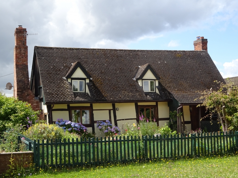
2.
C17 timber-framed cottage with brick infilling. One storey and attics. New
tile roof with 2 gabled attic dormers with casements. External brick stacks.
Three windows; 2 casements, one modern; fixed glazing. Half-glazed door.
Listing NGR: SO7974545358
External links are from the relevant listing authority and, where applicable, Wikidata. Wikidata IDs may be related buildings as well as this specific building. If you want to add or update a link, you will need to do so by editing the Wikidata entry.


Other nearby listed buildings
