Approximate Location Map
Large Map »
Latitude: 52.1172 / 52°7'1"N
Longitude: -2.3284 / 2°19'42"W
OS Eastings: 377608
OS Northings: 246590
OS Grid: SO776465
Mapcode National: GBR 0FN.64L
Mapcode Global: VH934.L1FS
Plus Code: 9C4V4M8C+VJ
Entry Name: 60, Worcester Road
Listing Date: 11 May 1979
Grade: II
Source: Historic England
Source ID: 1266850
English Heritage Legacy ID: 152190
ID on this website: 101266850
Location: Link Top, Malvern Hills, Worcestershire, WR14
County: Worcestershire
District: Malvern Hills
Civil Parish: Malvern
Built-Up Area: Great Malvern
Traditional County: Worcestershire
Lieutenancy Area (Ceremonial County): Worcestershire
Church of England Parish: Malvern The Holy Trinity
Church of England Diocese: Worcester
Tagged with: Building
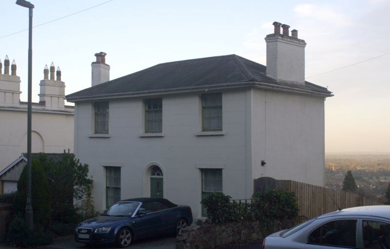
WORCESTER ROAD
1.
5245
(East Side)
No 60
SO 7746 NE 1/172
II GV
2.
Early C19. Two storeys, rough rendered, hipped slate roof with wide eaves.
Three windows, hung sashes with glazing bars. Two longer windows to ground
floor and door of 5 panels in round-headed doorway with radiating fanlight.
Listing NGR: SO7760846590
External links are from the relevant listing authority and, where applicable, Wikidata. Wikidata IDs may be related buildings as well as this specific building. If you want to add or update a link, you will need to do so by editing the Wikidata entry.


Other nearby listed buildings
