Approximate Location Map
Large Map »
Latitude: 52.0277 / 52°1'39"N
Longitude: -2.4398 / 2°26'23"W
OS Eastings: 369919
OS Northings: 236681
OS Grid: SO699366
Mapcode National: GBR FY.GHD6
Mapcode Global: VH860.N9JD
Plus Code: 9C4V2HH6+33
Entry Name: Milestone at National Grid Reference So 6990 3668
Listing Date: 10 January 1986
Grade: II
Source: Historic England
Source ID: 1082602
English Heritage Legacy ID: 152494
ID on this website: 101082602
Location: County of Herefordshire, HR8
County: County of Herefordshire
Civil Parish: Ledbury
Traditional County: Herefordshire
Lieutenancy Area (Ceremonial County): Herefordshire
Church of England Parish: Ledbury
Church of England Diocese: Hereford
Tagged with: Milestone
LEDBURY RURAL CP A449 (north-west side)
SO 63 NE
3/67 Milestone at NGR SO 6990 3668
-
- II
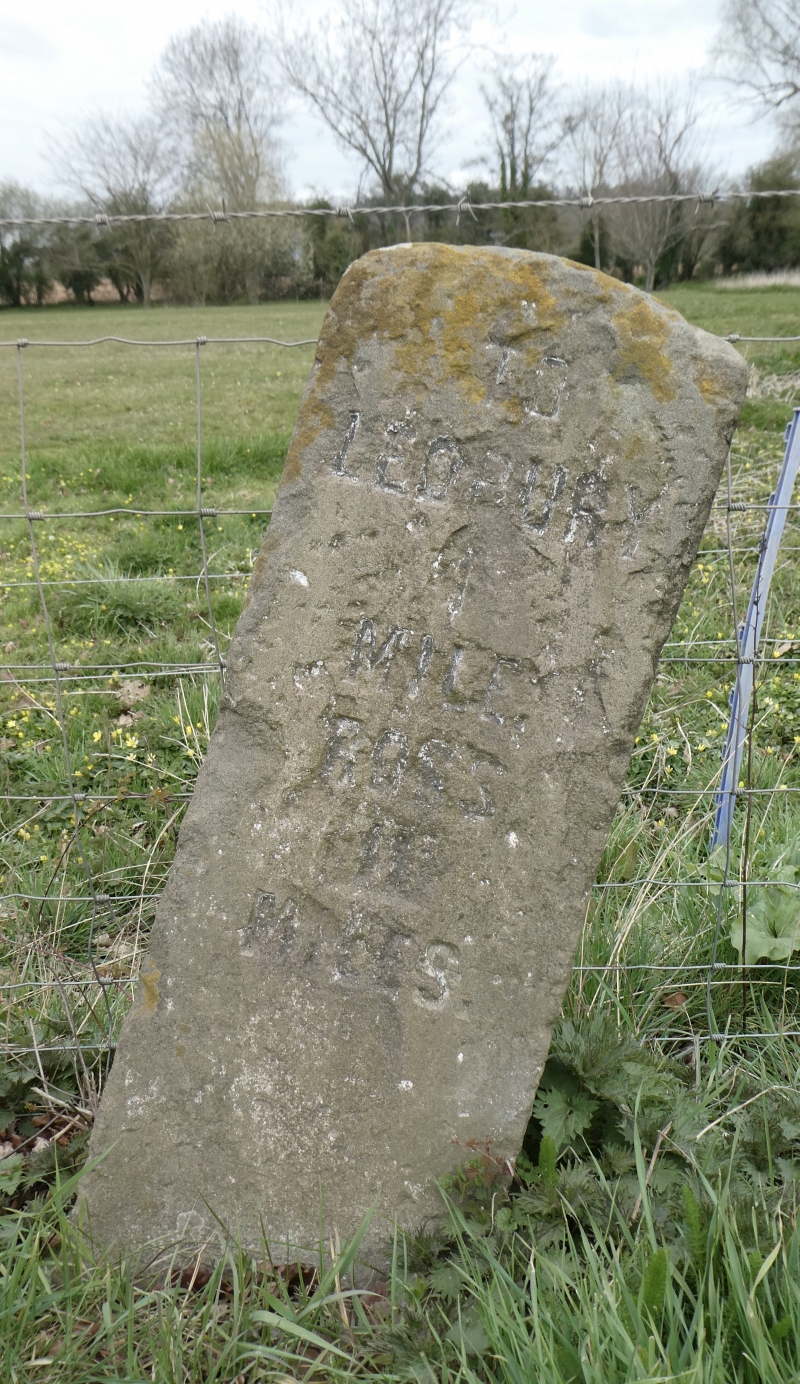
Milestone. Mid C19. Freestone upright with segmental head. Incised
lettering reads: "TO/ LEDBURY/ 1/ MILE/ ROSS/ 11/ MILES." Part of
a complete group of milestones in the Ledbury area.
Listing NGR: SO6991936680
External links are from the relevant listing authority and, where applicable, Wikidata. Wikidata IDs may be related buildings as well as this specific building. If you want to add or update a link, you will need to do so by editing the Wikidata entry.


Other nearby listed buildings
