Approximate Location Map
Large Map »
Latitude: 52.0495 / 52°2'58"N
Longitude: -2.4287 / 2°25'43"W
OS Eastings: 370700
OS Northings: 239104
OS Grid: SO707391
Mapcode National: GBR FZ.F05P
Mapcode Global: VH85T.VRF5
Plus Code: 9C4V2HXC+RG
Entry Name: Milestone at National Grid Refernce So 7070 3911
Listing Date: 10 January 1986
Grade: II
Source: Historic England
Source ID: 1082605
English Heritage Legacy ID: 152500
ID on this website: 101082605
Location: County of Herefordshire, HR8
County: County of Herefordshire
Civil Parish: Ledbury
Built-Up Area: Ledbury
Traditional County: Herefordshire
Lieutenancy Area (Ceremonial County): Herefordshire
Church of England Parish: Ledbury
Church of England Diocese: Hereford
Tagged with: Milestone
LEDBURY RURAL CP BROMYARD ROAD
SO 73 NW (south-west side)
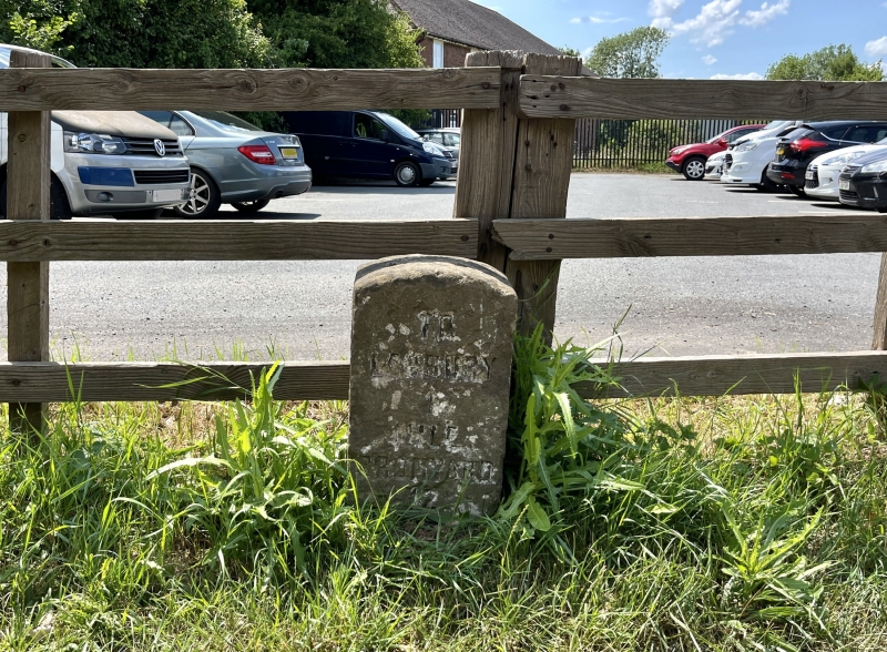
4/73 Milestone at NGR SO 7070 3911
-
- II
Milestone. Mid-C19. Freestone upright with segmental head. Incised
lettering reads: "TO/ LEDBURY/ 1/MILE/ BROMYARD/ 12/ MILES". Part of
a complete series of milestones in the Ledbury area.
Listing NGR: SO7070039104
External links are from the relevant listing authority and, where applicable, Wikidata. Wikidata IDs may be related buildings as well as this specific building. If you want to add or update a link, you will need to do so by editing the Wikidata entry.


Other nearby listed buildings
