Approximate Location Map
Large Map »
Latitude: 52.1713 / 52°10'16"N
Longitude: -2.2945 / 2°17'40"W
OS Eastings: 379954
OS Northings: 252605
OS Grid: SO799526
Mapcode National: GBR 0DX.W5J
Mapcode Global: VH92S.5PV9
Plus Code: 9C4V5PC4+G5
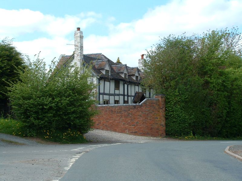
Entry Name: Fir Tree House
Listing Date: 9 February 1988
Grade: II
Source: Historic England
Source ID: 1349220
English Heritage Legacy ID: 153319
ID on this website: 101349220
Location: Bransford, Malvern Hills, Worcestershire, WR6
County: Worcestershire
District: Malvern Hills
Civil Parish: Bransford
Built-Up Area: Bransford
Traditional County: Worcestershire
Lieutenancy Area (Ceremonial County): Worcestershire
Church of England Parish: Leigh and Bransford
Church of England Diocese: Worcester
Tagged with: House
BRANSFORD CP CHAPEL LANE
SO 75 SE
2/6 Fir Tree House
- II
House. Probably early C18. Timber-framing on brick base with tile roof.
Framed in three rows of square panels. One storey with attic. Three windows
to left of door and two to right; two under eaves. Four gabled attic dormers.
Gable chimneys.
Listing NGR: SO7995452605
External links are from the relevant listing authority and, where applicable, Wikidata. Wikidata IDs may be related buildings as well as this specific building. If you want to add or update a link, you will need to do so by editing the Wikidata entry.


Other nearby listed buildings
