Approximate Location Map
Large Map »
Latitude: 52.0056 / 52°0'20"N
Longitude: -2.6116 / 2°36'41"W
OS Eastings: 358113
OS Northings: 234310
OS Grid: SO581343
Mapcode National: GBR FQ.HW7Y
Mapcode Global: VH85X.PV6C
Plus Code: 9C4V294Q+79
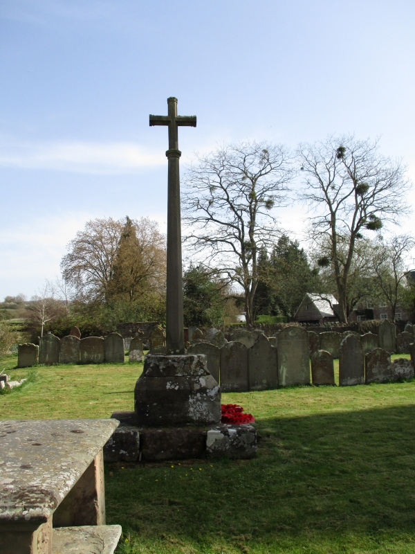
Entry Name: Churchyard Cross
Listing Date: 11 October 1985
Grade: II
Source: Historic England
Source ID: 1302130
English Heritage Legacy ID: 154892
ID on this website: 101302130
Location: Fownhope, County of Herefordshire, HR1
County: County of Herefordshire
Civil Parish: Fownhope
Built-Up Area: Fownhope
Traditional County: Herefordshire
Lieutenancy Area (Ceremonial County): Herefordshire
Church of England Parish: Fownhope
Church of England Diocese: Hereford
Tagged with: Churchyard cross
FOWNHOPE CP FOWNHOPE
SO 53 SE
7/46 Churchyard Cross
GV II
Churchyard cross. Possibly C15. C20 shaft and cross. Ashlar, rectangular
plinth and base with chamfered corners giving upper octagonal plan.
Listing NGR: SO5811434306
External links are from the relevant listing authority and, where applicable, Wikidata. Wikidata IDs may be related buildings as well as this specific building. If you want to add or update a link, you will need to do so by editing the Wikidata entry.


Other nearby listed buildings
