Approximate Location Map
Large Map »
Latitude: 52.0337 / 52°2'1"N
Longitude: -2.6274 / 2°37'38"W
OS Eastings: 357058
OS Northings: 237438
OS Grid: SO570374
Mapcode National: GBR FP.G4WM
Mapcode Global: VH85X.D4WT
Plus Code: 9C4V29MF+F3
Entry Name: Churchyard Cross
Listing Date: 26 January 1967
Grade: II*
Source: Historic England
Source ID: 1099815
English Heritage Legacy ID: 155002
ID on this website: 101099815
Location: Holy Rood Church, Mordiford, County of Herefordshire, HR1
County: County of Herefordshire
Civil Parish: Mordiford
Traditional County: Herefordshire
Lieutenancy Area (Ceremonial County): Herefordshire
Church of England Parish: Mordiford
Church of England Diocese: Hereford
Tagged with: Churchyard cross
MORDIFORD CP MORDIFORD
SO 53 NE
5/141 Churchyard Cross
26.1.67
GV II*
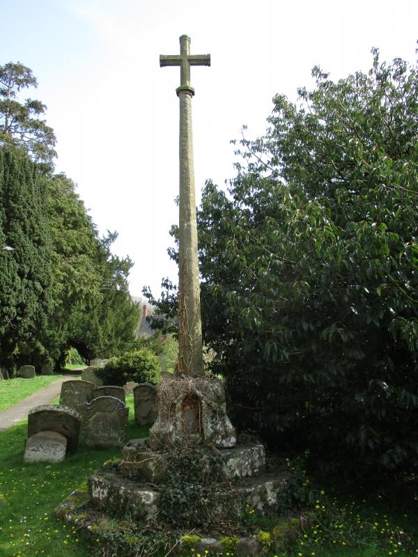
Churchyard cross. C14 or C15. Sandstone ashlar, octagonal stepped plinth,
square base with chamfered corners and pointed niche in west face with
gable, octagonal shaft, mid-C19 cross.
Listing NGR: SO5705837439
External links are from the relevant listing authority and, where applicable, Wikidata. Wikidata IDs may be related buildings as well as this specific building. If you want to add or update a link, you will need to do so by editing the Wikidata entry.


Other nearby listed buildings
