Approximate Location Map
Large Map »
Latitude: 51.97 / 51°58'11"N
Longitude: -2.8086 / 2°48'30"W
OS Eastings: 344550
OS Northings: 230477
OS Grid: SO445304
Mapcode National: GBR FG.L1YY
Mapcode Global: VH78K.8RL5
Plus Code: 9C3VX59R+XH
Entry Name: Kilpeck Court Farmhouse
Listing Date: 29 September 1952
Grade: II
Source: Historic England
Source ID: 1157819
English Heritage Legacy ID: 155575
ID on this website: 101157819
Location: Kilpeck, County of Herefordshire, HR2
County: County of Herefordshire
Civil Parish: Kilpeck
Traditional County: Herefordshire
Lieutenancy Area (Ceremonial County): Herefordshire
Church of England Parish: Kilpeck
Church of England Diocese: Hereford
Tagged with: Farmhouse
KILPECK CP KILPECK
SO 43 SW
2/40 Kilpeck Court Farmhouse
29.9.52
GV II
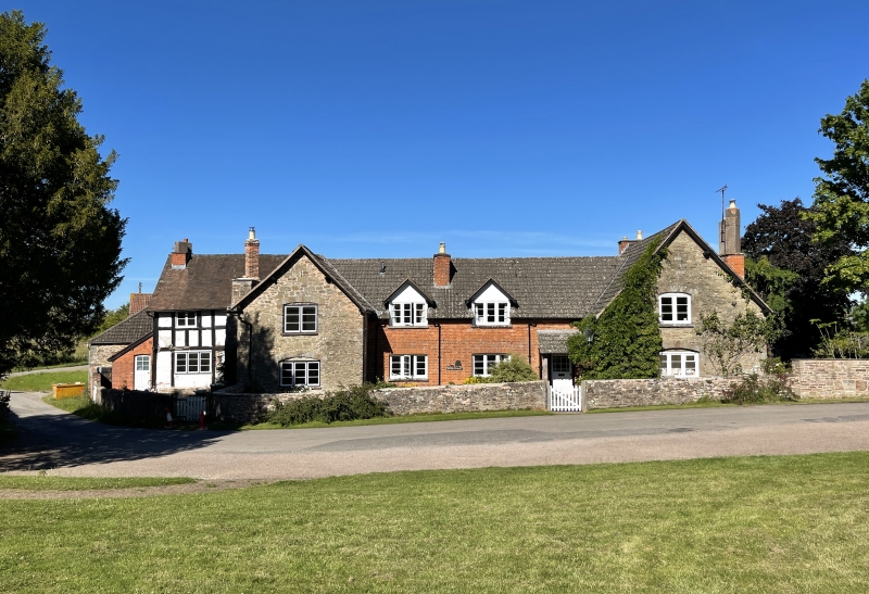
Farmhouse, now sub-divided into two tenements. c1600 with later C18 and
early to mid-C19 additions and alterations. Timber-framed earlier core
with part wattle-and-daub and part painted brick infill on sandstone rubble
plinth; sandstone rubble and red brick later alterations and additions; part
tiled and part C20 concrete tiled roofs. Former L-plan house extended to
south-east and to north-east; gable-end and lateral stacks. Part two storeys
and part single-storey and attics, south-west front; timber-framed wing to
left of four square panels from sill to wall-plate with one 2-light casement
window; ledged door in angle to right. Gabled wing projects forward with 2-
light casement window to first floor and 3-light window to ground floor.
Central block with two gabled dormer windows and two 3-light casement windows;
similar window to ground floor to left of lean-to porch and part glazed door.
Gabled projecting wing to right with one 2-light casement window to first
floor and similar 3-light window to ground floor. Later additions to rear now
form granary to rear at north-east and extension at north-west end has part
hipped roof and originally used as cider house. Interiors of both parts of
house inaccessible at time of resurvey (July 1986) but believed to retain
staircase with pierced and shaped balusters mentioned by RCHM. (RCHM, Vol I,
p 159).
Listing NGR: SO4454830483
External links are from the relevant listing authority and, where applicable, Wikidata. Wikidata IDs may be related buildings as well as this specific building. If you want to add or update a link, you will need to do so by editing the Wikidata entry.


Other nearby listed buildings
