Approximate Location Map
Large Map »
Latitude: 52.3768 / 52°22'36"N
Longitude: -2.0454 / 2°2'43"W
OS Eastings: 397007
OS Northings: 275418
OS Grid: SO970754
Mapcode National: GBR 2FC.ZNF
Mapcode Global: VH9ZD.HJK9
Plus Code: 9C4V9XG3+PR
Entry Name: Gate Piers East of No 61
Listing Date: 28 April 1952
Grade: II
Source: Historic England
Source ID: 1099546
English Heritage Legacy ID: 155690
ID on this website: 101099546
Location: Lydiate Ash, Bromsgrove, Worcestershire, B61
County: Worcestershire
District: Bromsgrove
Civil Parish: Catshill and North Marlbrook
Built-Up Area: Catshill
Traditional County: Worcestershire
Lieutenancy Area (Ceremonial County): Worcestershire
Church of England Parish: Bromsgrove
Church of England Diocese: Worcester
Tagged with: Gatepost
HALSOWEN ROAD,
1.
909 LYDIATE ASH
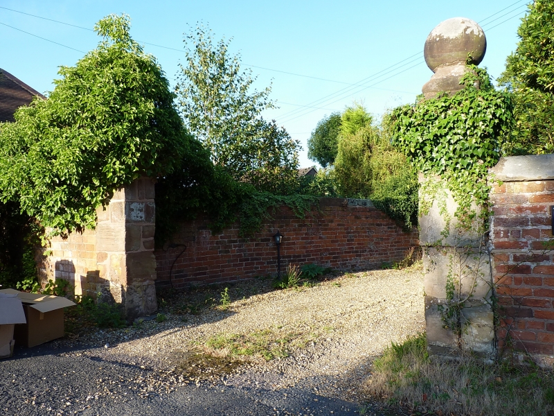
Gate Piers East
of No 61
SO 97 NE 8/104 28.4.52
II
Two pairs of stone gate piers with moulded cornice and ball finials in C18
brick wall.
Listing NGR: SO9700775418
External links are from the relevant listing authority and, where applicable, Wikidata. Wikidata IDs may be related buildings as well as this specific building. If you want to add or update a link, you will need to do so by editing the Wikidata entry.


Other nearby listed buildings
