Approximate Location Map
Large Map »
Latitude: 52.3368 / 52°20'12"N
Longitude: -2.1069 / 2°6'24"W
OS Eastings: 392811
OS Northings: 270978
OS Grid: SO928709
Mapcode National: GBR 2FW.G4V
Mapcode Global: VH923.FJJF
Plus Code: 9C4V8VPV+P6
Entry Name: Barn and Stables About 30 Yards East of Bungay Lake Farmhouse
Listing Date: 17 July 1986
Grade: II
Source: Historic England
Source ID: 1301026
English Heritage Legacy ID: 156348
ID on this website: 101301026
Location: Park Gate, Bromsgrove, Worcestershire, B61
County: Worcestershire
District: Bromsgrove
Civil Parish: Dodford with Grafton
Traditional County: Worcestershire
Lieutenancy Area (Ceremonial County): Worcestershire
Church of England Parish: Dodford Holy Trinity
Church of England Diocese: Worcester
SO 97 SW DODFORD WITH GRAFTON CP BUNGAY LAKE LANE (west side)
9/83 Barn and stables about
30 yards east of
Bungay Lake Farmhouse
GV II
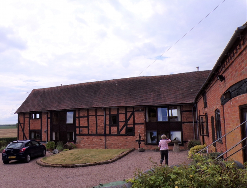
Barn and stable. C17 with mid-C18 and mid-C19 alterations and additions.
Part timber-framed with some brick infill, partly weatherboarded on sandstone
and brick base, partbrick; corrugated asbestos roof. Originally of three
framed bays aligned north/south with central wagon bay; two additional bays
added at north end in C18, the bay nearest the original part forming another
wagon bay; both wagon bays have opposed cart entries. Framing: partly three
rows of panels and partly long rectangular panels from sill to wall-plate;
collar and tie-beam truss with four struts at south end. Brick part to
north has header ventilation courses and a loft door with a cambered head
in the gable end. Interior: roof has intermediate collar and tie-beam trusses
with struts and two tiers of trenched purlins. C19 stable adjoins to north-
east; brick with plain tiled roof; two levels, dentilled eaves cornice;
roughly three bays; south elevation has two doors and a window with cambered
heads and a loft opening. Blocked through-archway at east end with timber
lintel to north and south. External sandstone and brick steps at east end
lead up to loft door with cambered head.
Listing NGR: SO9281170978
External links are from the relevant listing authority and, where applicable, Wikidata. Wikidata IDs may be related buildings as well as this specific building. If you want to add or update a link, you will need to do so by editing the Wikidata entry.


Other nearby listed buildings
