Approximate Location Map
Large Map »
Latitude: 52.3576 / 52°21'27"N
Longitude: -2.1068 / 2°6'24"W
OS Eastings: 392822
OS Northings: 273290
OS Grid: SO928732
Mapcode National: GBR 2FP.26F
Mapcode Global: VH923.F0KG
Plus Code: 9C4V9V5V+37
Entry Name: Brae Side
Listing Date: 12 May 1976
Grade: II
Source: Historic England
Source ID: 1348593
English Heritage Legacy ID: 156372
ID on this website: 101348593
Location: Dodford, Bromsgrove, Worcestershire, B61
County: Worcestershire
District: Bromsgrove
Civil Parish: Dodford with Grafton
Built-Up Area: Dodford
Traditional County: Worcestershire
Lieutenancy Area (Ceremonial County): Worcestershire
Church of England Parish: Dodford Holy Trinity
Church of England Diocese: Worcester
Tagged with: Architectural structure
SO 97 SW DODFORD WITH GRAFTON CP WOODLAND ROAD (east side)
Dodford
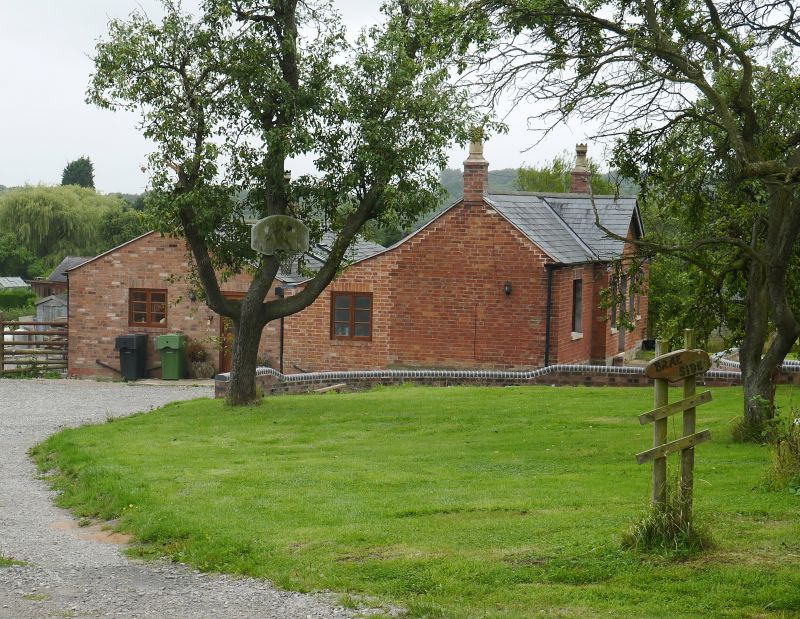
9/109 Brae Side
12.5.76
GV II
House. c1848 with late C20 alterations and additions. Brick on sandstone
base, slate roof with ridge end and rear stacks. Rectangular three-bay plan.
Single storey. Main north front articulated 1:1:1 bays; central part breaks
forward slightly and is gabled with moulded bargeboards on shaped brackets;
2-light casements in original openings in outer bays; central part has a
large C20 multi-paned bar window replacing original front entrance door and
flanking windows. Trefoil opening in stone triangle in gable apex. Main
entrance now at left side. C20 additions at rear. One of 40 similar Chartist
houses in Dodford built mainly on four-acre plots by the Chartist Land Company.
As on other Chartist estates each small-holding was intended to provide the
occupant with an independent livelihood and,the opportunity to qualify for a
county vote. Situated in a row with Laburnum Cottage (qv) and Malvern View (qv).
Included for group value.
Listing NGR: SO9282273290
External links are from the relevant listing authority and, where applicable, Wikidata. Wikidata IDs may be related buildings as well as this specific building. If you want to add or update a link, you will need to do so by editing the Wikidata entry.


Other nearby listed buildings
