Approximate Location Map
Large Map »
Latitude: 52.3678 / 52°22'3"N
Longitude: -2.1816 / 2°10'53"W
OS Eastings: 387728
OS Northings: 274428
OS Grid: SO877744
Mapcode National: GBR 1D2.F8H
Mapcode Global: VH91W.4RH7
Plus Code: 9C4V9R99+48
Entry Name: South Bridge to Harvington Hall
Listing Date: 18 March 1987
Grade: II
Source: Historic England
Source ID: 1100672
English Heritage Legacy ID: 157016
ID on this website: 101100672
Location: Harvington, Wyre Forest, Worcestershire, DY10
County: Worcestershire
District: Wyre Forest
Civil Parish: Chaddesley Corbett
Traditional County: Worcestershire
Lieutenancy Area (Ceremonial County): Worcestershire
Church of England Parish: Kidderminster East
Church of England Diocese: Worcester
CHADDESLEY CORBETT CP HARVINGTON
SO 87 SE
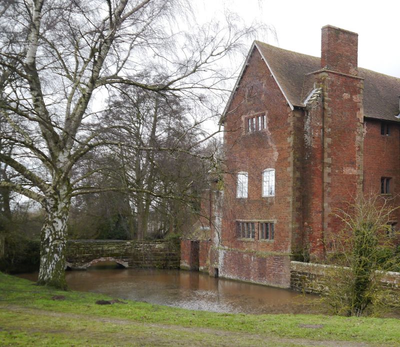
10/29 South bridge to
Harvington Hall
GV II
Bridge spanning moat. Probably C17. Brick and sandstone ashlar. Two
low segmental brick arches support plain sandstone parapet.
Listing NGR: SO8772874428
External links are from the relevant listing authority and, where applicable, Wikidata. Wikidata IDs may be related buildings as well as this specific building. If you want to add or update a link, you will need to do so by editing the Wikidata entry.


Other nearby listed buildings
