Approximate Location Map
Large Map »
Latitude: 51.8939 / 51°53'38"N
Longitude: -0.215 / 0°12'53"W
OS Eastings: 522927
OS Northings: 223216
OS Grid: TL229232
Mapcode National: GBR J82.6GD
Mapcode Global: VHGP0.7N6G
Plus Code: 9C3XVQVP+H2
Entry Name: Norton Green Farmhouse
Listing Date: 30 September 1976
Grade: II
Source: Historic England
Source ID: 1176880
English Heritage Legacy ID: 158104
ID on this website: 101176880
Location: Stevenage, Hertfordshire, SG1
County: Hertfordshire
District: Stevenage
Electoral Ward/Division: Symonds Green
Parish: Non Civil Parish
Traditional County: Hertfordshire
Lieutenancy Area (Ceremonial County): Hertfordshire
Church of England Parish: Stevenage Holy Trinity
Church of England Diocese: St.Albans
Tagged with: Farmhouse
1.
5257 NORTON GREEN
------------
Norton Green Farmhouse
TL 22 SW 6/140
II
2,
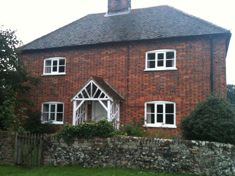
C18. Red stretchers, grey headers, hipped old tiled roof with corbelled cornice.
2 storeys, 2 nearly flush casement windows with cambered arches. C19 gabled wood
porch over 4 panelled door. Lower back wing.
Listing NGR: TL2292723216
External links are from the relevant listing authority and, where applicable, Wikidata. Wikidata IDs may be related buildings as well as this specific building. If you want to add or update a link, you will need to do so by editing the Wikidata entry.


Other nearby listed buildings
