Approximate Location Map
Large Map »
Latitude: 51.6169 / 51°37'0"N
Longitude: -0.4245 / 0°25'28"W
OS Eastings: 509176
OS Northings: 192068
OS Grid: TQ091920
Mapcode National: GBR 2N.ZL2
Mapcode Global: VHFSS.LMFC
Plus Code: 9C3XJH8G+P6
Entry Name: London Coal Duty Marker on county boundary on bank on east side of railway about 350 metres south of road
Listing Date: 3 October 1985
Grade: II
Source: Historic England
Source ID: 1348237
English Heritage Legacy ID: 158765
ID on this website: 101348237
Location: Northwood, Hillingdon, London, HA6
County: London
District: Hillingdon
Electoral Ward/Division: Northwood
Parish: Non Civil Parish
Built-Up Area: Hillingdon
Traditional County: Middlesex
Lieutenancy Area (Ceremonial County): Greater London
Church of England Parish: Emmanuel Northwood
Church of England Diocese: London
Tagged with: Coal duty marker Coal-tax post
This list entry was subject to a Minor Amendment on 02/08/2018
TQ 0918 9206
9/122
RICKMANSWORTH
Northwood
BATCHWORTH LANE (South side)
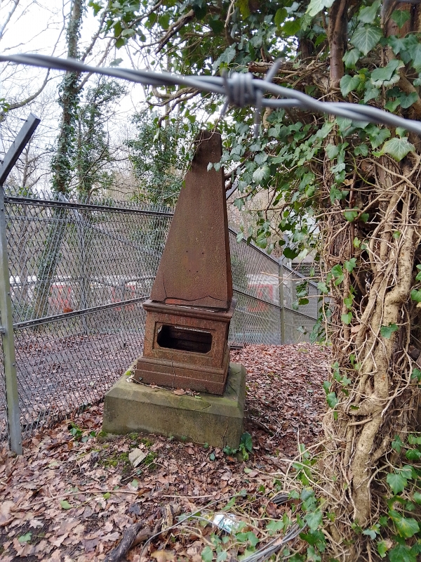
London Coal Duty Marker on county boundary on bank on east side of railway about 350 metres south of road
(Formerly listed as London Coal Duty Marker on County Boundary on east railway embankment about 350 metres south of road)
II
City of London Coal Duty Marker. Installed about 1887. Cast by Falkirk Iron Co. Ltd. Square stone base with chamfered top to cast-iron square with four open panels and a moulded cornice above which rises a short obelisk, the whole one and a half to two metres high. Marked extent of coal duty, originally 20 miles circumference from General Post Office, moved in 1861 to point on boundary of Metropolitan Police District. See Stockers House, STOCKERS FARM ROAD.
Listing NGR: TQ0917692068
External links are from the relevant listing authority and, where applicable, Wikidata. Wikidata IDs may be related buildings as well as this specific building. If you want to add or update a link, you will need to do so by editing the Wikidata entry.


Other nearby listed buildings
