Approximate Location Map
Large Map »
Latitude: 51.8808 / 51°52'50"N
Longitude: 0.0272 / 0°1'37"E
OS Eastings: 539628
OS Northings: 222190
OS Grid: TL396221
Mapcode National: GBR LC7.1P2
Mapcode Global: VHHLL.FZ6K
Plus Code: 9F32V2JG+8V
Entry Name: Knights Court
Listing Date: 24 January 1967
Last Amended: 23 November 1983
Grade: II*
Source: Historic England
Source ID: 1347492
English Heritage Legacy ID: 161049
ID on this website: 101347492
Location: Standon, East Hertfordshire, SG11
County: Hertfordshire
District: East Hertfordshire
Civil Parish: Standon
Built-Up Area: Puckeridge
Traditional County: Hertfordshire
Lieutenancy Area (Ceremonial County): Hertfordshire
Church of England Parish: Standon
Church of England Diocese: St.Albans
Tagged with: Building
Standon
TL 39 22 STANDON HADHAM ROAD
(north side)
7/16 Knights Court
(formerlylisted as
24.1.67 School)
GV II*
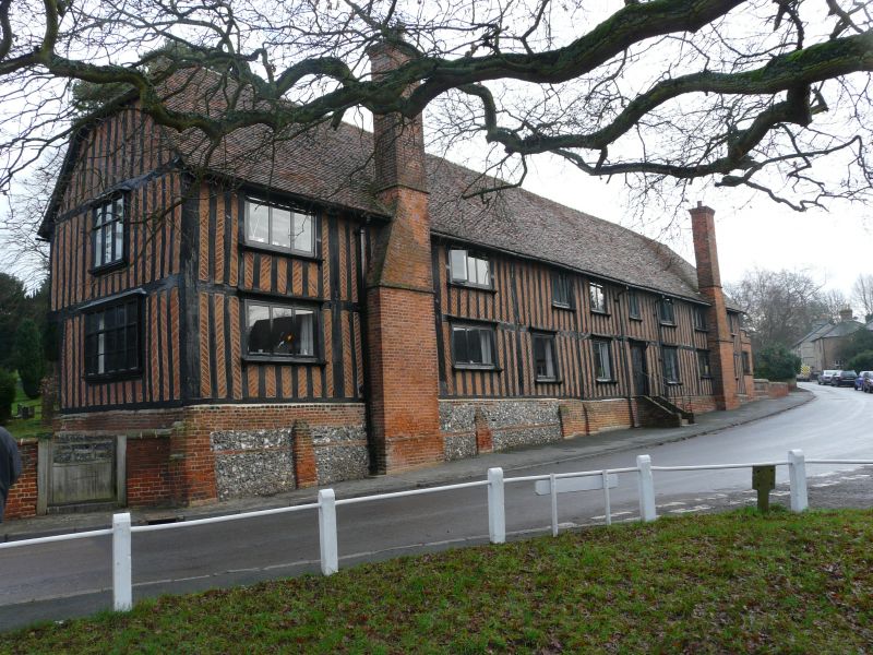
Manorial courthouse, schoolhouse from before 1612 to c1980, now 4
houses. C16 or earlier. Exposed timber frame with close-
studding infilled with herringbone C19 red brickwork. Flint and
brick base. 2 external lateral red brick chimneys on S side.
Steep old red tile roof, half hipped at ends. 2 storeys and 9
structural bays. Continuous jetty on N side facing churchyard.
2-light casement windows set flush (renewed) with bracketed sills
and dripboards. W gable has C19 mullioned end transomed wood
windows, 3-light above 5-light, with moulded sills. Door up 5
steps central on S, boarded with elaborate decorative hinges.
C19 E extension for Girls school not of special interest. (RCHM
(1911) 208: VCH (1912) 349).
Listing NGR: TL3962822190
External links are from the relevant listing authority and, where applicable, Wikidata. Wikidata IDs may be related buildings as well as this specific building. If you want to add or update a link, you will need to do so by editing the Wikidata entry.


Other nearby listed buildings
