Approximate Location Map
Large Map »
Latitude: 52.0487 / 52°2'55"N
Longitude: -0.0244 / 0°1'27"W
OS Eastings: 535573
OS Northings: 240761
OS Grid: TL355407
Mapcode National: GBR K7Q.DNJ
Mapcode Global: VHGNB.JRGV
Plus Code: 9C4X2XXG+F6
Entry Name: 16, Kneesworth Street
Listing Date: 11 June 1976
Grade: II
Source: Historic England
Source ID: 1295665
English Heritage Legacy ID: 161783
ID on this website: 101295665
Location: Royston, North Hertfordshire, SG8
County: Hertfordshire
District: North Hertfordshire
Civil Parish: Royston
Built-Up Area: Royston
Traditional County: Cambridgeshire
Lieutenancy Area (Ceremonial County): Hertfordshire
Church of England Parish: Royston
Church of England Diocese: St.Albans
Tagged with: Building
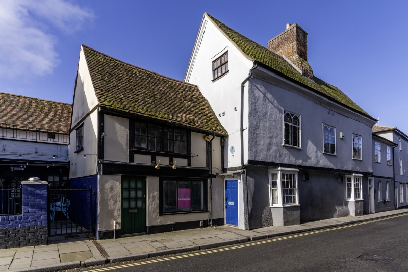
1.
5255 KNEESWORTH STREET
(West Side)
No 16
TL 3540 1/143
II GV
2.
C16 or C17, altered. Colour washed brick ground floor, timber frame and plaster
1st floor, old tiled roof. 2 storeys, ground floor 3 light window, 1st floor
flush casement window with glazing bars.
Nos 14 to 22 (even) form a group.
Listing NGR: TL3557340761
External links are from the relevant listing authority and, where applicable, Wikidata. Wikidata IDs may be related buildings as well as this specific building. If you want to add or update a link, you will need to do so by editing the Wikidata entry.


Other nearby listed buildings
