Approximate Location Map
Large Map »
Latitude: 51.8648 / 51°51'53"N
Longitude: -0.2219 / 0°13'18"W
OS Eastings: 522529
OS Northings: 219961
OS Grid: TL225199
Mapcode National: GBR J8F.4Q6
Mapcode Global: VHGP6.3DJ9
Plus Code: 9C3XVQ7H+W6
Entry Name: Milepost at Junction of Driver's End Lane and Park Lane
Listing Date: 21 March 1984
Grade: II
Source: Historic England
Source ID: 1102795
English Heritage Legacy ID: 161958
ID on this website: 101102795
Location: Nup End Green, North Hertfordshire, SG3
County: Hertfordshire
District: North Hertfordshire
Civil Parish: Codicote
Traditional County: Hertfordshire
Lieutenancy Area (Ceremonial County): Hertfordshire
Church of England Parish: Codicote
Church of England Diocese: St.Albans
Tagged with: Milestone
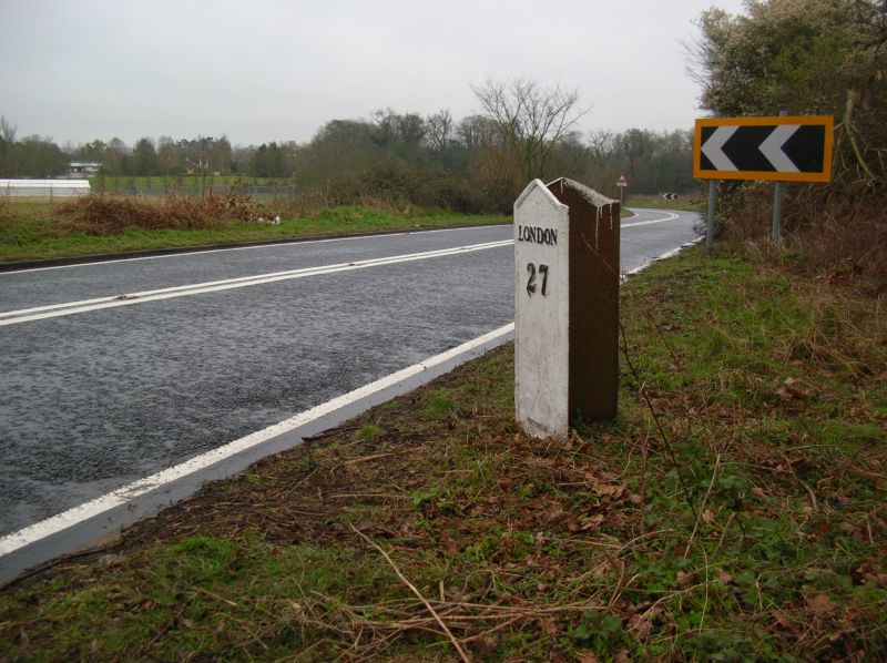
DRIVER'S END LANE
TL 21 NW CODICOTE (north side)
Nup End Green
7/13 Milepost at junction of
Driver's End Lane
- and Park Lane
- II
Milepost. Mid C19. White Painted cast iron. Triangular plan.
2 triangular-headed panels inscribed 'HITCHIN 7 LONDON 27' in
black Roman-style capitals.
Listing NGR: TL2252919961
External links are from the relevant listing authority and, where applicable, Wikidata. Wikidata IDs may be related buildings as well as this specific building. If you want to add or update a link, you will need to do so by editing the Wikidata entry.


Other nearby listed buildings
