Approximate Location Map
Large Map »
Latitude: 53.5066 / 53°30'23"N
Longitude: -0.8663 / 0°51'58"W
OS Eastings: 475286
OS Northings: 401698
OS Grid: SE752016
Mapcode National: GBR QWDW.7Q
Mapcode Global: WHFFJ.N4P3
Plus Code: 9C5XG44M+JF
Entry Name: Farmhouse Approximately 660 Metres North West of Sykers Farmhouse
Listing Date: 10 September 1987
Grade: II
Source: Historic England
Source ID: 1067773
English Heritage Legacy ID: 165174
ID on this website: 101067773
Location: North Lincolnshire, DN9
County: North Lincolnshire
Civil Parish: Haxey
Traditional County: Lincolnshire
Lieutenancy Area (Ceremonial County): Lincolnshire
Church of England Parish: Haxey St Nicholas
Church of England Diocese: Lincoln
Tagged with: Farmhouse
SE 70 SE HAXEY HAXEY TURBARY
SE 7529 0170
11/110 Farmhouse approximately
660 metres north-west of
Skyers Farmhouse
- II
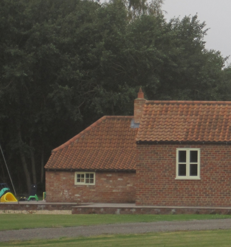
Farmhouse. Mid C19. Brick with pantile roof, whitewashed throughout
(including roof). 2 rooms with continuous rear outshut. Single storey, 2
windows. South front has enclosed entrance porch/outhouse to right angle.
12-pane sliding sash and C20 casement in original opening to left. Hipped
roof, central ridge stack. Right return has 12-pane sliding sash, with
small 4-pane sliding sash to outshut. Rear has small 3-light and single-
light windows. Parts of Haxey Turbary or Carr (commons where peat turf was
formerly collected) were divided around the mid C19 into small plots
(usually one acre) and let for a low rent, creating a distinct settlement
pattern of intensively farmed smallholdings with very small cottages, few of
which survive in anything like their original form. A similar process
occurred with the turbaries in Epworth (qv), Belton and Crowle parishes.
One of the smallest and least altered examples of the turbary farmhouses
still remaining. Included for historical interest.
Listing NGR: SE7528601698
External links are from the relevant listing authority and, where applicable, Wikidata. Wikidata IDs may be related buildings as well as this specific building. If you want to add or update a link, you will need to do so by editing the Wikidata entry.


