Approximate Location Map
Large Map »
Latitude: 53.5521 / 53°33'7"N
Longitude: -0.4936 / 0°29'36"W
OS Eastings: 499900
OS Northings: 407222
OS Grid: SE999072
Mapcode National: GBR SWZC.YD
Mapcode Global: WHGGG.DZ67
Plus Code: 9C5XHG24+VH
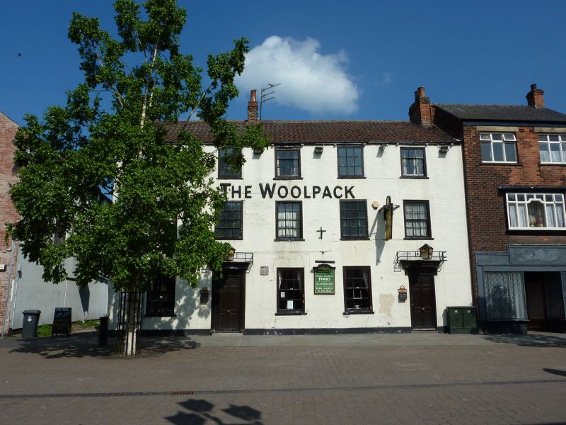
Entry Name: The Woolpack Inn
Listing Date: 6 August 1976
Grade: II
Source: Historic England
Source ID: 1083128
English Heritage Legacy ID: 165472
Also known as: The Woolpack, Brigg
Woolpack
ID on this website: 101083128
Location: Brigg, North Lincolnshire, DN20
County: North Lincolnshire
Civil Parish: Brigg
Built-Up Area: Brigg
Traditional County: Lincolnshire
Lieutenancy Area (Ceremonial County): Lincolnshire
Church of England Parish: Brigg St John the Evangelist
Church of England Diocese: Lincoln
MARKET PLACE
1.
5264
(North Side)
No 4
(The Woolpack Inn)
SE 90 NE 1/20
II GV
2.
Late C18 building of 3 storeys, rough rendered, with 5 windows, 2 with replaced
hung sashes with glazing bars. Ground floor has 4 windows and door in modern
surrounds. Plinth.
Nos 2 to 4 (consec) form a group.
Listing NGR: SE9990007221
External links are from the relevant listing authority and, where applicable, Wikidata. Wikidata IDs may be related buildings as well as this specific building. If you want to add or update a link, you will need to do so by editing the Wikidata entry.


Other nearby listed buildings
