Approximate Location Map
Large Map »
Latitude: 54.0937 / 54°5'37"N
Longitude: -0.2039 / 0°12'14"W
OS Eastings: 517561
OS Northings: 467918
OS Grid: TA175679
Mapcode National: GBR WP03.N8
Mapcode Global: WHHF6.VC2H
Plus Code: 9C6X3QVW+FC
Entry Name: 15-17, Kirkgate
Listing Date: 7 September 1951
Grade: II
Source: Historic England
Source ID: 1346529
English Heritage Legacy ID: 166158
ID on this website: 101346529
Location: Old Town, East Riding of Yorkshire, YO16
County: East Riding of Yorkshire
Civil Parish: Bridlington
Built-Up Area: Bridlington
Traditional County: Yorkshire
Lieutenancy Area (Ceremonial County): East Riding of Yorkshire
Church of England Parish: Bridlington Priory Church (St Mary)
Church of England Diocese: York
Tagged with: Building
1.
5268 KIRKGATE
(North Side)
Nos 15 to 17 (consec)
TA 1767 NE 2/27 7.9.51.
II GV
2.
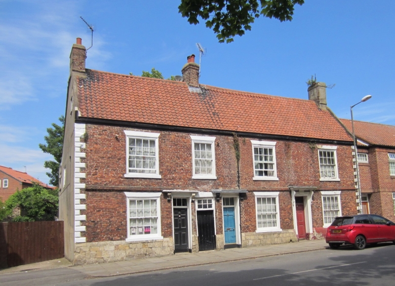
Late C17 or early C18. 2 storeys in brick with stone plinth. Steep pantile roof
with 3 stacks. Brick band between storeys is broken. 3 brick stacks. Wood eaves
cornice. Rusticated quoins, part damaged. 4 windows, hung sashes with glazing
bars, 1 narrower, painted brick heads. 3 windows to ground floor. 3 windows to
ground floor. 3 doors of 6 fielded panels beneath 3-light rectangular fanlight.
One original doorcase with moulded architrave and pulvinated frieze with panel,
small dentil cornice breaks round it. 2 later doorways of harmonious design.
All 3 have small flat hoods on consoles. Rectangular fanlight to passage entry.
Nos 15 to 20 (c nsec) Kirkgate form a group with The Bayle Gate. Baylegate; Nos
11 to 16 (consec), Baylegate; Nos 4 to 8 (consec), Kirkgate; Church of St Mary,
Kirkgate; Nos 15 to 18 (consec), Church Green and Nos 20 to 22 (consec) Church
Green, Nos 11 to 16 (consec), Baylegate are of local interest.
Listing NGR: TA1755567915
External links are from the relevant listing authority and, where applicable, Wikidata. Wikidata IDs may be related buildings as well as this specific building. If you want to add or update a link, you will need to do so by editing the Wikidata entry.


Other nearby listed buildings
