Approximate Location Map
Large Map »
Latitude: 53.7421 / 53°44'31"N
Longitude: -0.1989 / 0°11'56"W
OS Eastings: 518882
OS Northings: 428806
OS Grid: TA188288
Mapcode National: GBR WT15.Q9
Mapcode Global: WHHGY.X6FL
Plus Code: 9C5XPRR2+RC
Entry Name: 23 and 25, Souttergate
Listing Date: 22 February 1979
Grade: II
Source: Historic England
Source ID: 1346581
English Heritage Legacy ID: 166436
ID on this website: 101346581
Location: Hedon, East Riding of Yorkshire, HU12
County: East Riding of Yorkshire
Civil Parish: Hedon
Built-Up Area: Hedon
Traditional County: Yorkshire
Lieutenancy Area (Ceremonial County): East Riding of Yorkshire
Church of England Parish: Hedon St Augustine
Church of England Diocese: York
Tagged with: Building
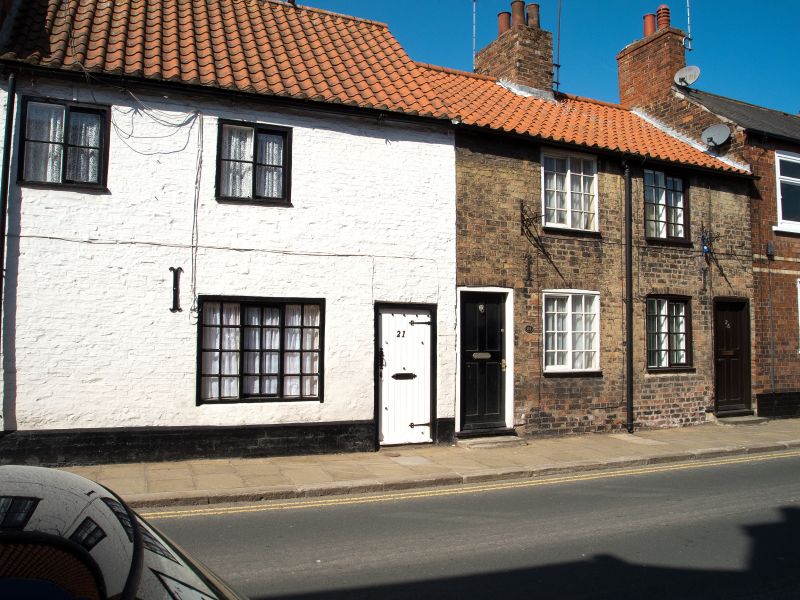
SOUTTERGATE
1.
5266
(West Side)
Nos 23 and 25
TA 1828 NE 1/89
II GV
2.
Early C19. Colour-washed brick. Pitched pantile roof. Two storeys. Two
ranges of sliding sashes with glazing bars. Two doors, each with 6 sunk panels.
Listing NGR: TA1888028804
External links are from the relevant listing authority and, where applicable, Wikidata. Wikidata IDs may be related buildings as well as this specific building. If you want to add or update a link, you will need to do so by editing the Wikidata entry.


Other nearby listed buildings
